
View Proposal - Connecticut Institute for Resilience & Climate
 building-up a resilient development and transportation
network to support vulnerable communities
May 1, 2015
May 1, 2015
TABLE OF CONTENTS
Executive Summary ......................................................................................................................................... 19
Threshold Requirements ................................................................................................................................. 21
Capacity .......................................................................................................................................................... 25
Need ............................................................................................................................................................... 31
Consultation ...................................................................................................................................................... 1
Concept ............................................................................................................................................................ 4
Outcomes ....................................................................................................................................................... 13
Leverage ......................................................................................................................................................... 14
Long-term Commitment ................................................................................................................................. 16
18 EXECUTIVE SUMMARY
New Haven and Fairfield counties were designated as most impacted and distressed counties
due to Hurricane Sandy, the Qualifying Disaster for this competition. Sandy damaged 2,853 singlefamily homes in Fairfield County and 1,165 in New Haven County. Unmet recovery needs in these
counties total more than $158 million from housing ($135,789,167) and infrastructure ($22,510,508).
This unmet need includes eight public housing properties in the 100-year floodplain. If Connecticut
were to assess all resilient repair needs the additional need would be in the hundreds of millions of
dollars. Coastal communities are home to 60% of the state’s population and more than 32,000
homes lie within the 100-year floodplain. Connecticut has the second highest exposure of vulnerable
coastal assets on the east coast. With more than $542 billion in assets at risk to coastal storms; only
Florida has a greater exposure.
The Applicant, the State of Connecticut’s Department of Housing (DOH), is working with the
State Agencies for Resilience (SAFR, pronounced safer) to address these risks and prepare and
implement the NDRC proposal. SAFR includes representatives from eight state agencies. SAFR is
supported by 19 additional partners including the regional Councils of Government, Connecticut
Conference of Municipalities, University of Connecticut, Yale, Partnership for Strong Communities,
Housing Development Fund, Connecticut Green Bank, the state’s largest utility companies, several
environmental organizations, The Red Cross, CT Rises, and the Tremaine Foundation. All Partners
have incorporated resilience to the impacts of severe weather, sea level rise and climate change into
their core mission or programs.
To address Connecticut’s vulnerabilities, this proposal outlines a long-term vision for
establishing more resilient coastal communities where structures and critical infrastructure in the
flood zone are adapted to withstand occasional flooding and protected by healthy buffering
ecosystems, where critical services, infrastructure and transport hubs are located on safer, higher
ground, and where strong connections exist between the two. Increasing investment in identified
resilience zones provides an opportunity to increase economic resilience by strongly tying back to
the regional transportation network and regional economic opportunities. Therefore, these
investments represent a ‘no regrets’ approach to climate adaptation because in addition to
providing long-term resilience, they provide a myriad of co-benefits that strengthen communities
and economic opportunities in the short term and between storms.
To develop this proposal the team undertook a robust process of public outreach and
engagement. This process built upon the lessons learned in Rebuild by Design and numerous other
community resiliency processes. The process included over 50 consultations, 3 public hearings and
open houses, a project website, site visits, and social media campaigns. This enriched the Phase 1
19 discovery process, informed the resiliency strategy, resulted in numerous partnerships (with more to
come) and will continue to shape the Phase 2 application.
The concept is closely aligned with state spending priorities, including the Governor’s priority
of a “best-in-class transportation system.” As a member of SAFR, Connecticut’s Department of
Transportation pledged to coordinate appropriate projects in their FY15 $1.7 billion capital budget
with the NDRC proposal. Other SAFR partners have committed to exploring similar opportunities
during Phase 2, if selected. The state has already committed $500,000 to the CDBG-NDR
application, and the team has identified potential sources of leverage funding totally over $2.75
billion.
Connecticut has demonstrated its long-term commitment to building back better through the
Connecticut Climate Preparedness Plan, which advanced legally mandated efforts to prepare for
climate change. The State has reduced coastal vulnerabilities through the passage of two new laws,
the dedication of new resources to the Microgrids program, and the creation of the Connecticut
Institute for Resilience and Climate Adaptation and Shore Up Connecticut, a low-interest loan
program for flood mitigation.
20 THRESHOLD REQUIREMENTS
General Section. The State of Connecticut is in compliance with the requirements of the General
Section.
Eligible applicant. The Applicant is the State of Connecticut.
Eligible county. The eligible counties in the State of Connecticut are Fairfield (County/in PMSA
1160,1930,5760,8040) and New Haven (County/in PMSA 1160,5480,8880). New Haven and Fairfield
counties were both impacted by Disaster Number 4087, incident type: Hurricane, incident title:
Hurricane Sandy, incident begin date: 2012-10-27, and end date: 2012-11-08.
Most impacted and distressed target area. The target areas identified as most impacted and
distressed (MID) as a result of Hurricane Sandy (DR-4087) are Fairfield and New Haven counties.
These counties were previously determined by HUD to be most impacted.
Unmet recovery needs threshold. The State of Connecticut has Unmet Recovery Needs (URN)
(needs that have not been addressed by federal, state, or other sources) in excess of $158 million in
housing and infrastructure in the MID areas of Fairfield and New Haven counties.
Owner occupied housing. DOH is administering an Owner-Occupied Rehabilitation and
Rebuilding program targeted to assist 1-4 unit owner-occupied properties, addressing rehabilitation
and mitigation/elevation needs. Tranche 1 (T1) CDBG-DR funding addressed unmet rehabilitation
needs, alone or in conjunction with mitigation/elevation needs. Tranche 2 (T2) CDBG-DR funds
addressed mitigation/elevation needs of 1-4 unit owner-occupied properties damaged by Hurricane
Sandy whose rehabilitation was addressed through insurance proceeds, FEMA assistance and/or
SBA assistance. We anticipate awarding and expending all of the available Tranche 1 and Tranche 2
funds allocated for these activities ($44.2M). The Tranche 3 (T3) plan proposes distributing
$6,886,050 to owner-occupied housing and the remaining $4,572,950 to multi-family housing,
infrastructure, administration and planning, and $10M to Resilient Bridgeport RBD. DOH does not
anticipate the number of houses damaged by the disaster to go below 20 even after T3 funds are
allocated.
Owner Occupied housing Data Source Analysis. In the Dropbox folder Spreadsheet 1 is a
detailed breakdown by county of the homeowners currently being assisted or intended to be
assisted with an estimated cost of activity, including CDBG-DR, insurance, FEMA and SBA.
Spreadsheet 2 is a detailed breakdown of homeowners who have applied for assistance, but for
whom funds are not currently available. In order to accomplish this analysis, we made the following
assumptions: (1) There is remaining Unmet Need existing among homeowners in both New Haven
21 and Fairfield Counties consisting of those on our current application list; (2) Mitigation/elevation
needs exist in both counties consisting of those on our current application list; (3) Cost estimates for
Unmet Need in Spreadsheet 2 were determined using the average cost of assisted or to-beassisted homeowners in the respective counties from Spreadsheet 1. The Summary Table of
Unmet Need – Owner Occupied below shows the number of current applicants seeking assistance
with remaining unmet rehabilitation or with unmet mitigation/elevation needs, which cannot be
addressed with other sources through CDBG-DR, insurance, FEMA, SBA. Table Legend: Avg. Asst =
Average Assistance from other sources (Insurance, FEMA, SBA); Total Asst. = Total Assistance from
other sources; and URN = Unmet Recovery Need (URN calculated as Total Need minus Total Asst.).
The Summary Table of Unmet Need – Owner Occupied Housing
#
County
Fairfield
Avg.
Houses
Avg. Cost
Total Need
Asst.
Total Asst.
URN
99
$181,579 $17,976,315
$67,186 $6,651,414
$11,324,923
74
$175,325 $12,974,098
$52,139 $3,858,286
$9,115,794
New
Haven
Total URN –Owner Occupied Housing after Tranche 3 CDBG-DR allocation = $13,554,621
Multi- family housing. DOH is administering a Multi-family Rehabilitation/Rebuilding and
Mitigation program (T1 p. 53), targeted at low and moderate-income (LMI) multifamily properties
with unmet need, and emphasizes state or federal public housing. DOH anticipated using leverage
(state taxable and tax exempt bond financing, federal Low Income Housing Tax Credits (LIHTC)
(both 4% and 9% credits), as well as conventional financing for housing) and thus allocated
$26,000,000 in CDBG-DR funding to address these needs. To date, DOH has targeted the majority
of the $26,000,000 available on three separate public housing replacement activities (T3, p.9).
The Summary Table of Unmet Need – multifamily shows remaining unmet need for rehabilitation or
replacement of these units (T3, p.9). T3 proposes to distribute $3,000,000 to multi-family (T3, p.19).
Not all of the funds identified in the “Estimated Assistance Other Sources” column have received
commitments, therefore unmet need may be greater than estimated. Table Legend: (T.D.C. = Total
Development Cost; CDBG-DR = CDBG-DR Assistance; E.A.O. = Estimated Assistance Other Sources
22 (DOH/LIHTC/Other); URN = Unmet Recovery Need, URN calculated from T.D.C minus CDBG-DR
minus E.A.O.)
Summary Table of Unmet Need – Multi- family Housing
County
# Units
T.D.C.
CDBG-DR
E.A.O.
URN
Fairfield
911
$315,463,287
$23,230,000
$191,998,787
$100,234,500
New Haven
140
$43,000,000
$0
$18,000,000
$25,000,000
Total URN –Multifamily after Tranche 3 CDBG-DR allocation = $122,234,500
Summary of unmet housing need. There is unmet housing need in the MID counties, Fairfield
and New Haven, in excess of $135,789,167 after proposed T3 (Figures 1-3).
Infrastructure. In the most impacted target areas there is damage to permanent public
infrastructure from the qualifying disaster, Hurricane Sandy, which has not been repaired. The
following is the remaining infrastructure repair needs in the target area sent to DOH. The location of
damage by county and municipality and a damage summary for each project is as follows: (Dropbox
file names: Town Name_Descriptor)
Fairfield County: Fairfield_Pump Station – over two feet of Sandy flood waters stayed behind after
storm, flooding one square mile of land and homes; Greenwich_Point Park – wave and wind damage
to park structures and erosion of natural features, living shoreline for damage prevention proposed;
Westport_Bridge – Sandy waves dislodged bridge to island, which was repaired, but not resilient to
future storms. Bridgeport_Marina Village – storm surge flooding damaged housing, proposal to
repair incorporates resilience.
New Haven County: Beacon Falls_WWTP – stormwater flooding at wastewater treatment plant along
river; Meriden_Harbor Brook – stormwater flooding along river; Milford_Point Beach – coastal storm
surge flooding damage of low-lying areas; Milford_Wepawaug – flooding along Wepawaug river,
dredging mitigation proposed; Oxford_Firehouse – firehouse flooded during Sandy; West
Haven_Tide Gate & Footbridge – tide gates and footbridge damaged from Sandy storm surge
flooding; West Haven_Culvert – culvert vulnerable to extensive flood damage from Sandy and future
storms; Ansonia-Derby_Water Tank – project to prevent loss of water pressure. The Data Sources has
23 the sources and uses for each project listed. The table below shows the total cost of repairs, other
sources of funding (ACE/FEMA/municipal) and the funding required to complete repairs.
Summary Table of Unmet Need – Infrastructure
County
Cost of Repairs
Other Funding Sources
Funding Needed
Fairfield
$15,301,536
$4,761,250
$10,540,286
New Haven
$17,322,742
$4,352,520
$12,970,222
Total Unmet Infrastructure Need after Tranche 3 CDBG-DR Allocation = $22,510,508
There are inadequate funds to complete the repairs because CDBG-DR funds have been exhausted.
Following Sandy there were 40 infrastructure projects requiring $157.4 million in funding. Of the
CDBG-DR funds awarded only $6.2 (T-1) and $30 (T-2) million have been dedicated to addressing
these needs. While T-3 proposes dedicating an additional $1 million to infrastructure, there will
remain an unmet need in excess of $22 million.
Summary of unmet infrastructure need. Based on the projects listed in the data source and
summarized above, there is an unmet infrastructure need of $22,510,508 after proposed T3.
Statement on eligible activity, resilience incorporated, national objective, overall benefit and
establish tie-back. Funds will be used solely for necessary expenses related to disaster relief, longterm recovery, restoration of infrastructure and housing, and economic revitalization in the most
impacted and distressed areas for which the President declared a major disaster in the aftermath of
an event occurring in 2011, 2012, or 2013, pursuant to the Stafford Act. The expectation is to
improve the resilience of the most impacted and distressed target area(s) to current and future
threat(s) and hazard(s), including effects of climate change. Connecticut has demonstrated taking at
least one permanent action to increase resilience in the target area, region or state. With respect to
activities expected to be assisted with CDBG–NDR funds, the Application has been developed so as
to give the maximum feasible priority to activities that will benefit low- and moderate-income (LMI)
families. The aggregate use of CDBG–NDR funds shall principally benefit LMI families in a manner
that ensures that at least 50 percent of the grant amount is expended for activities that benefit such
persons.
Benefit- cost analysis. There is no benefit-cost analysis associated with the Phase 1 application.
24 CAPACITY
General management capacity. The State of Connecticut’s Department of Housing (DOH) is the
Applicant and will coordinate partners and implement the activities proposed in this application.
Under P.L. 113-2, CT received $159,279,000 CDBG-DR funds. Governor Malloy designated DOH as
the principal state agency for allocation and administration of this funding. DOH currently maintains
a dedicated Sandy recovery staff team that has successfully administered, managed, distributed with sound financial and procurement processes - two rounds of CDBG-DR funding since the
Qualifying Disaster (Sandy). The DOH has prepared and executed a CDBG-DR Action Plan and two
substantial amendments to meet the housing needs of communities most impacted by the storm.
These needs included the costs of repairs, reconstruction and new construction which were not
covered by insurance, FEMA, or other sources of funding as well as infrastructure repairs, mitigation
projects, and planning activities (Exhibit D). Through this process DOH vetted contractors, issued
invitations to bid, issued contracts, oversaw contract execution, and coordinated with other agencies
to obtain the proper permits. DOH also manages and funds Shore Up CT, a low-interest mitigation
financing program (Exhibit G). DOH’s ability to initiate the Sandy program and programs like Shore
Up CT show its internal control capacity and ability to quickly launch and implement major projects
successfully. In order to provide quality assurance DOH will seek advisory assistance from all
Partners, from the interagency workgroup, State Agencies for Resilience (SAFR), which was created
to facilitate this application. SAFR members include lead staff from agencies that have supported
and committed resources to this application and building overall resilience in the state.
Application preparation. The Connecticut Institute for Resilience and Climate Adaptation
(CIRCA) at the University of Connecticut (UConn), a Partner on this application, was contracted to
support the development of this application through an MOU with a Partner agency, the
Department of Energy and Environmental Protection (DEEP). Through weekly meetings and daily
interactions, CIRCA engaged with DOH and SAFR to develop and review this proposal, catalogue
unmet needs, contribute technical knowledge, and direct community outreach. CIRCA and UConn
worked with Alex Felson Landscape Architects also from the Yale Urban Ecology and Design Lab to
develop the design vision. CIRCA will participate in Phase 2 and will continue to advise the State in
its primary role as a resilience research and outreach institute. CIRCA also attended the Rockefeller
Resilience Academy alongside representatives from DOH, OPM, and DESPP/DEMHS.
C ross- disciplinary technical capacity. The Applicant, DOH, will work across disciplines to
achieve project goals, and ensure excellent design quality by partnering with SAFR, faculty and staff
experts from UConn and Yale, and the Connecticut Conference of Municipalities and regional
Councils of Governments. The Applicant and Partners have experience with interdisciplinary work in
the following areas: designing, planning and implementing large, complex and comprehensive
25 projects; benefit-cost and data analysis; public works; affordable housing; environmental quality;
community engagement; design and engineering; and economic revitalization.
Applicant capacity. DOH strengthens and revitalizes communities by promoting affordable
housing opportunities and has significant experience working on civil rights and fair housing issues.
DOH seeks to eliminate homelessness and to catalyze the creation and preservation of quality,
affordable housing to meet the needs of all individuals and families. Major initiatives include the
Governor’s $300 million, 10-year capital investment in State-sponsored Housing Portfolio and the
Sandy CDBG-DR program, which includes data analysis of racial or economic disparities in its Action
Plan.
Partner capacity. For a full review of partner capacity see Attachment A.
C T Office of Policy and Management (OPM) is a co-chair of SAFR. OPM functions as the
Governor’s staff agency and plays a central role in state government, providing the
information and analysis used to formulate public policy and assisting state agencies and
municipalities in implementing policy decisions on the Governor’s behalf. OPM is the
coordinator of interagency problem-solving efforts, including Transit-Oriented Development,
and is the liaison between municipal and state government for this application.
The C T Department of Energy and Environmental Protection (DEEP) is a co-chair of
SAFR. DEEP’s mission is to conserve, improve, and protect natural resources and the
environment as well as to ensure availability of affordable, clean and reliable energy. DEEP
brings its experience co-leading CIRCA, implementing the Coastal Zone Management
program, which includes permitting structures for shoreline adaptation, administering CT’s
Clean Water Fund, developing energy, climate and resilience policy, and running the
Floodplain Management and the NFIP.
The Office of the Governor (OTG) ensures coordination between concepts proposed in
the application and gubernatorial priorities, including a focus on State-sponsored housing
revitalization and a “best-in-class transportation system”.
C T Department of Transportation (DOT) strives to provide a safe and efficient
intermodal transportation network that improves the quality of life and promotes economic
vitality. DOT’s $1.7 billion annual budget (2015) supports many highway, bridge, rail, bus,
water, bicycle, and pedestrian capital assets and operations, including many of which are
adjacent to waterways and vulnerable to flooding. DOT brings a wealth of experience on
Transit-Oriented Development; “Complete Streets” designs; Public-Private Partnerships,
Design-Build projects; alternative design concepts; procurement processes; and
26 transportation asset management.
The C T Department of Emergency Services and Public Protection/Division of
Emergency Management and Homeland Security (DESPP/DEMHS) advises SAFR on
emergency management and homeland security programs that encompass all human-made
and natural hazards, including prevention, mitigation, preparedness, response, and recovery
components to ensure the safety and well-being of citizens. This includes administering
FEMA’s Hazard Mitigation Assistance grant programs and Public Assistance Programs and
incorporating climate change risks into the Threat Hazard Identification and Risk Assessment,
State Preparedness Report and Connecticut’s State Hazard Mitigation Plan Update.
The Department of Public Health’s (DPH) vision is for healthy people in healthy
Connecticut communities and is charged with protecting and improving the health and safety
of the people of Connecticut. The DPH advocates health impact assessments (HIA) be
conducted where possible to ensure conditions in which people can be healthy.
C onnecticut Insurance Department (CID) provides assistance and information to the
public and to policy makers and regulates the insurance industry. Connecticut is one of only a
few states to request voluntary climate change disclosure surveys from insurance companies.
CID advises SAFR on the impacts of mitigation strategies and policies on insurance in the
state and provided key contacts with stakeholders from the insurance and reinsurance
industries.
The C T C onference of Municipalities (CCM) is the state’s association of towns and
cities. CCM brings community engagement and regional policy and planning experience to
assist SAFR.
The C T Department of Economic and C ommunity Development (DECD) advises
SAFR on comprehensive approaches to economic development and revitalization that
incorporate community development, transportation, and productive redevelopment of
brownfield properties by promoting smart growth principles and strengthening public-private
partnerships.
The University of C onnecticut. C onnecticut Institute for Resilience and C limate
Adaptation (CIRCA) fosters resilience of vulnerable communities along the state’s coast and
rivers to the impacts of climate change through transferable and replicable adaptation
solutions. CIRCA’s technical capacity for science-based analysis includes: impacts of climate
change, sea level rise, ocean dynamics, future precipitation and hydrology models, weather
prediction, environmental law, economics and policy analysis. CIRCA’s faculty contribute to
27 the National Climate Assessment and advise state, national and international bodies on
climate change.
UC onn Sea Grant is the state’s component of the NOAA national Sea Grant network and
has expertise in research and outreach including the Climate Adaptation Academy workshops
and the NOAA Sea Grant Coastal Storm Awareness Program.
UC onn C enter for Land Use Education and Research (CLEAR) provides information
and assistance to land use decision makers to balance growth and natural resource
protection.
Yale Urban Ecology and Design Laboratory (UEDLAB) provides landscape architecture
expertise. The UEDLAB was a member of the Resilient Bridgeport Rebuild by Design team
and has contributed to green infrastructure and coastal planning projects in Connecticut.
The Regional C ouncils of Government (COGs) serve the vital role of regional planning,
as Connecticut does not have county governments. The South Central Regional COG
(SCRCOG), Western Connecticut COG (WCCOG), and Greater Bridgeport Regional Council
(GBRC), facilitate regional initiatives and represent all municipalities in our MID-URN counties.
Partnership for Strong C ommunities is a statewide housing policy organization that
works to prevent and end homelessness, create affordable and mixed-income housing
(including in communities that have little or none) and foster community development
solutions.
The Housing Development Fund, Inc. (HDF) is a nonprofit organization dedicated to
financing the development of affordable housing and will work with SAFR to apply lessons
learned from existing lending programs including Shore Up CT, the state’s resiliency loan
fund. HDF in partnership with Yale is conducting an analysis of housing needs in 80 lowincome census tracts, which will assist in the analysis of unmet needs in the target area.
The Emily Hall Tremaine Foundation has been a key funder of state-level climate and
energy initiatives in Connecticut, including the State’s Climate Action Plan, and is looking to
fund resiliency innovations at the community scale. In addition, the foundation will utilize its
national funder affinity group involvement to raise the visibility of Connecticut’s efforts.
The Long Term Recovery C ommittee for the State of C onnecticut will help
coordinate through its participation in a number of joint working groups related to coastal
resilience.
C onnecticut C hapter of the American Red C ross and C T Rises have been
28 extensively involved in Sandy recovery efforts in Connecticut and will provide vital insight into
unmet need not identified through government channels.
EPA Long Island Sound Study, Save the Sound, and Audubon C onnecticut will
provide guidance on coastal adaptation measures, wildlife protection, and conservation
opportunities.
C onnecticut Green Bank, the nation’s first state green bank, leverages public and private
capital to drive investment and scale-up of clean energy and energy efficiency in Connecticut.
Their staff will provide important expertise on potential financing mechanisms for projects.
East C oast Greenway Alliance is developing a public trails network in the target counties
as part of a 2,900-mile system of paths, to connect communities from Maine to Florida.
UIL Holdings and Eversource Energy serve most electric and natural gas customers in
the state and will work closely with SAFR to coordinate electric and gas infrastructure
modifications to support the designed project and further enhance critical infrastructure
resiliency.
Maintaining partner capacity and obtaining future capacity. We have secured Partners
with a wide array of diverse and overlapping capacities and expertise. This redundancy provides
security, as well as great team depth and strength should Partner commitments change. All Partners
are committed to this application and have incorporated one or more aspects of resilience to the
impacts of severe weather, sea level rise and climate change into their core mission or programs.
Moreover, the Applicant, DOH, has run a CDBG-DR program for the past three years, and will
continue to do so if funds are awarded. In a Phase 2 application process, the State would engage
additional partners particularly at the local level and in the private sector. Many of the Partners have
existing contracts with firms that could provide additional technical (i.e. engineering) expertise. For
example, DOT has a pre-approved list of 135 consultants who could be used for engineering,
design, and planning.
C ost- benefit analysis. Our Partners have extensive experience with various cost-benefit analytical
(CBA) tools, and will be able to perform or contract for such analysis. DEMHS utilizes FEMA’s BCA
software to evaluate projects submitted to FEMA’s Hazard Mitigation Assistance programs. DOT has
an active Transportation Asset Management program with the capacity to inventory, inspect,
monitor and prioritize facilities for maintenance and capital project programs. DOT routinely
practices scenario planning including no-build alternatives, BCA and other advanced management
techniques to constrain its ongoing work program to available revenue.
29 C ommunity engagement capacity. DOH has a commitment to resident and community
engagement with established programs detailed in an Action Plan and two substantial amendments
for the CDBG-DR program. DOH and SAFR have engaged CIRCA, an institute dedicated to research
and outreach for communities impacted by climate change, to support DOH’s application and
identify the communities most vulnerable to future hazards. CIRCA’s Director of Community
Engagement is coordinating the application team. The community engagement processes is being
led by an AIA, LEED-AP nationally-recognized community design and developer who is working with
the Yale UEDLAB and a multidisciplinary team of highly qualified scientists, practitioners and
educators. All state agency partners, CCM and the regional councils of government, have extensive
experience with community engagement and planning. Partners have extensive engagement
experience through multiple projects including Rebuild by Design, local and international landscape
architecture projects, rebuilding in New Orleans, national resilience charrettes and leading a
Community Development Corporation that rehabilitated over 1,500 buildings.
Process for incorporating community feedback. Phase 2 would include the continued
involvement of Phase 1 stakeholders; however, as the projects move closer to implementation
engagement would shift to direct engagement of community members, neighborhood associations,
and municipalities. The process to identify unmet needs and means of addressing these needs
includes: early and frequent consultation; documentation and response to comments and
suggestions; participatory workshops. Many partners worked with Rebuild by Design in Bridgeport
to engage the community through a variety of methods including the All Scales Workshop where
leaders from more than 40 organizations, including many based in the impacted community, worked
alongside a cadre of professionals developing proposals for resilient community development. This
engagement model serve as a precedent for future engagement. DPH is exploring the potential to
integrate a rapid Health Impact Assessment (HIA) into the community engagement process.
Empowering community leaders. DOH supports a number of initiatives to build community
leadership, such as the CT Housing Coalition’s Connecticut Emerging Leaders Network and the
Affordable Housing Academy. As an example, the Yale UEDLAB has worked for over four years with
residents from Bridgeport’s vulnerable South End neighborhood to build, maintain and adapt a
community-driven flood management and green infrastructure project in the floodplain. UConn’s
Climate Adaptation Academy is educating officials about adaptation measures.
Harmonizing contributions from diverse stakeholders. The Partnership for Strong
Communities has an extensive record of bringing together diverse constituencies to find solutions
reaching beyond the specific interests of housing advocates, developers and human service
providers typically involved in housing policy. Other partners, including the COGS, which provide
regional planning support, have extensive experience with community development through
30 participatory activities. This includes research and publication about the use of social media in
community development, development of the first website used as a tool for community comment,
and development of open house techniques that positively engage divergent voices.
Regional and multi- governmental capacity. DOH is the lead agency making all final
allocations of funding; however, the DOH will coordinate and plan all projects with Partners,
specifically those of the interagency task force SAFR, which was created for the purposes of this
application. DOH and the SAFR representatives have extensive experience working on multi-agency
projects and through public private partnerships including work specific to Sandy recovery. DOH and
agency partners work on a statewide and regional basis and are approaching this proposal as an
opportunity to develop best practices that can be applied strategically in other locations throughout
the state, region, and nation, where appropriate. Many SAFR partners, including the Connecticut
Council of Municipalities, the regional Councils of Governments, Partnership for Strong
Communities, and Long Island Sound Study bring significant regional planning experience and are
similarly working to replicate best practices regionally.
The State’s proposed approach, detailed in Exhibit E, builds directly on the physical features shared
among coastal communities. The approach details vulnerable coastal typologies, or common
conditions that repeat along the state’s coastline. The state’s vulnerabilities have been framed in this
way so that solutions can be more easily replicated and implemented in communities that may not
have been as hard hit by Sandy, but are nevertheless highly vulnerable to the future storms.
The State has also considered how addressing vulnerabilities to climate change can be used to
reduce economic disparities and improve opportunities for low- and moderate-income families using
transit-oriented development with options for affordable housing as a means to improve economic
resilience. By integrating climate resilience efforts into ongoing economic and community
development initiatives will increase the state’s ability there is a greater potential to address classrelated disparities that exacerbate the vulnerabilities of low- and moderate-income families at risk in
the floodplain.
NEED
Summary of the most impacted and distressed target area. The target areas identified
as most impacted and distressed as a result of Hurricane Sandy (DR-4087) are Fairfield and New
Haven counties. These counties were previously determined by HUD to be the most impacted.
Summary of unmet need.
31 Housing vulnerability. Flooding and rising sea level will significantly affect coastal
communities, which are home to 60% of the state’s population. More than 32,000 homes lie
within Connecticut’s 100-year floodplain (CT Natural Hazard Mitigation Plan, 2010), which,
according to FEMA, places more than $18 billion in assets at risk. Sandy damaged 2,853 singlefamily homes in Fairfield County and 1,165 in New Haven County (Att.E, p116-118). There are still
99 homes in Fairfield and 74 homes in New Haven Counties seeking assistance post-Sandy. After
the Tranche 3 CDBG- DR allocation is spent, there will be a remaining unmet need of
$13,554,667 for owner-occupied housing (Exhibit B, p. 4). A more substantial investment is
required to adapt the state’s housing stock to new conditions. Where homeowners have
maintained equity in their homes as their only major financial asset, there is a risk of severe
financial impacts from flooding. Much of the vulnerable housing stock was originally built as
seasonal beach cottages before 1990, the first year when provisions for wind and flooding
damage were included in state law, and therefore is not able to withstand strong storms or new
flood risks (CT NHMP Update, 2014).
Damage to multi-family housing developments from Sandy was concentrated in Fairfield and New
Haven Counties (Att.E, p.119). In total, 1,298 units sustained damage. Three public housing
properties (581 units) sustained the most damage. In total, eight public housing properties in the
FEMA 100-year floodplain need to be elevated, rehabilitated or relocated, at a total cost of $358
million with an unmet need of $125 million. The state faces a shortage of affordable housing and
many existing affordable housing units need mitigation measures to protect against the effects of
climate change (Att.E, p.120-121). Maintaining economically diverse communities and availability
of affordable housing options is a high priority for the State.
Unmet infrastructure and resiliency needs. Bridgeport has significant unmet resiliency
needs identified during Rebuild by Design (RBD). The Resilient Bridgeport project outlines an
innovative and comprehensive approach to protecting the city’s vulnerable South End, Black Rock
and downtown neighborhoods from climate hazards and to supporting economic revitalization.
While the State was awarded $10 million, there is a substantial unmet need for implementation.
The initial proposal estimated a cost of $291 million; however, through subsequent planning the
estimated cost to provide essential flood protection and remediation has been revised to
$302,714,000. This leaves an unmet need of $292,714,000. The project design may be scaled
back; however, providing essential flood protection requires a contiguous network of flood
defenses, which will cost more than $65 million for the South End alone.
Impacts to infrastructure. Aging infrastructure is an overarching challenge, which will be
32 exacerbated by extreme weather events. There is damage to permanent public infrastructure
following Sandy that has not been repaired and CDBG-DR funds have been exhausted. The total
unmet need for infrastructure is $22,510,508; however, this represents a small fraction of the total
mitigation needs for the infrastructure in the state.
Transportation. The east-west transportation corridor is particularly challenged as it runs
through the coastal towns and suffers from high traffic volumes. The coastal east-west corridor is
a critical travel link for the Northeastern U.S. because there is no alternative passenger rail route
between Boston, New Haven, and New York City. In several locations the rail line roadbed is the
first line of coastal flood defenses as it acts as a berm on the inland edge of the floodplain. I-95 &
CT-15 are the primary highway links between New York City and Boston. During storms,
vulnerable points, hindered by drainage systems designed for a pre-climate change world, along
these routes hinder
the movement of residents and emergency vehicles. Designed for a different era, much of the
drainage infrastructure has insufficient capacity to handle increases in storm runoff and surge.
Water. The water infrastructure is similarly vulnerable. Sandy impacted local drinking water
systems. Most systems lost street power; smaller public water systems lost water supply due to the
lack of emergency power. In some cases street power was lost for 5-7 days, which made large
water system generators vulnerable to failure. Further interconnections between public water
systems do not exist in most situations, making it impossible to share drinking water during
emergency events like Sandy. Sewer and wastewater treatment systems, including those in
Fairfield and Stratford were also impacted. By design, wastewater treatment plants are located
close to receiving waters at the low points so sewage can be cost-effectively fed to the treatment
facility without pumping.
Power. Many plants were inches away from extensive damage during Sandy. Had storm
characteristics been slightly different, they could have been severely disabled. A rise in sea level
may have serious repercussions on the functioning of treatment plants and sewer networks. A
DEEP study found that up to 10% of sewer service areas and up to 5% of pumping stations could
be affected by a 1m rise in sea level. Both sea level rise and erosion can undermine private septic
systems in the coastal zone. Norwalk, Bridgeport, and New Haven still have combined sewer
systems which are often overwhelmed during times of heavy rain, leading to discharge of
untreated or partially-treated waste, which negatively impacts the Sound. Existing flood defenses,
such as berms and surge barriers, were designed for historical storm events; they will become
vulnerable to overtopping and offer reduced protection as precipitation events become more
33 intense and sea levels rise.
Power. The state’s power generation and supply infrastructure is particularly vulnerable; a
significant percentage is in need of retrofitting to protect facilities from flooding. For example,
despite protective barriers, a Bridgeport electrical facility has begun to experience flooding at high
tide (McCarthy, 2013). Substations are similarly vulnerable.
Characteristics of Fairfield and New Haven counties. The demographic information for
the two counties is contained in (Att.E, p.122-123).; however, it is important to note that
minorities (8-67%) and the elderly (13-27%) make up a significant percentage of the population in
many of the impacted communities (Many of the areas most impacted by Sandy are also areas
with a high percentage of low- and moderate-income (LMI) residents (Att.E, p.124-125). This
clustering of
low-income neighborhoods near the coast indicates that there may be disproportionate effects on
low-income communities. The Social Vulnerability Index (SoVI®) highlights a clustering of socially
vulnerable areas in the floodplain, particularly in urban areas (Att.E, p.126-127). Hurricane surge
data overlayed on the SoVi map demonstrates that highly vulnerable populations are specifically
vulnerable to flooding (Att.E, p.128-129). A CCM report on disproportionate burdens shows that 4
out of the 25 towns categorized as “distressed” were among those Sandy seriously affected.
(Att.E, p.130). Sandy inundation and the anticipated flooding from a Category 3 Hurricane were
mapped for each municipality. (Att.E, p.131-146). Coupled with 12” of sea level rise, flooding will
be devastating at the local scale (Att.E. p.147). As a result, Connecticut has the second highest
exposure of vulnerable coastal assets on the east coast. With more than $542 billion in assets (or
64% of properties) at risk to coastal storms; only Florida has a greater exposure. Since 1950 NOAA
has recorded over 600 severe floods in Connecticut. Although a number of flood control measures
exist, as the FEMA Hazard Maps show, most of the coast remains directly exposed to flooding.
(Att.E, p.148-149). Moreover, anticipated inundation from future hurricanes along the shores of
New Haven and Fairfield Counties is extensive (Att.E, p.150-151).
This exposure will be exacerbated by climate change. As described in the U.S. National Climate
Assessment, New England saw more than a 70% increase in the amount of precipitation falling in
very heavy events between 1958 and 2010 (Att.E, p.152). By 2050 it is estimated that the
Connecticut coast will see a rise in sea levels between 27 and 50 cm (Kopp et al., 2014). (Att.E,
p.153). Nor’easters, which have been striking with greater frequency and intensity since the 1970s
(New England Aquarium, 2009) have contributed to more frequent flooding in Connecticut.
34 Comprehensive risk assessment approach- mapping physical vulnerabilities. The U.S.
Army Corps of Engineers (USACE) recently completed the North Atlantic Coast Comprehensive
Study Report, which included a detailed analysis of the state’s shoreline. USACE identified areas
vulnerable to inundation using SLOSH modeling conducted by NOAA. USACE established an
exposure index to describe population and infrastructure density, social vulnerability, and
environmental and cultural resources. These were combined to identify areas with a higher flood
risk (Att.E, p.154-161). This assessment identified 15 areas meriting further analysis, 8 of which fall
within the Most Impacted and Distressed counties (Att.E, p.162-163).
Our science-based risk assessment therefore focuses on a more detailed analysis within these
identified areas to help guide eventual project selection (Att.E, p.164). Vulnerable areas are being
mapped based on the following factors: 1) within the 100-year flood zone, 2) expected to be
affected by sea level rise by 2050, 3) have the least topographic change, 4) are built on glacial
deltas or filled wetlands, and 5) areas that become isolated due to limited or impassable egresses
during times of flooding (Att.E, p.165). Next, areas of historic flooding were identified using 1)
individual properties damaged by Sandy (Att.E, p.166-167), 2) areas with repetitive and severe
repetitive loss properties (Att.E, p.168-171), and 3) areas with the greatest damage during Sandy
and Irene (measured by expenditure through FEMA’s IHP grants (Att.E, p.172).Third, areas of
social vulnerability were identified by 1) the Social Vulnerability Index (SoVI®) composite score
(Att.E, p.126-127) and 2) low or moderate income areas (identified by HUD for FY2014) (Att.E,
p.124- 125).
Vulnerable coastal typologies. Connecticut’s complex geology means flooding risk is closely
tied to a high occurrence of glacial delta deposits, which are inherently more erodible (Att.E,
p.173- 174). The variegated character of the coast makes large-scale collective coastal
engineering works, designed to prevent floodwaters from entering, technically challenging and
costly. Because of the site variability, each community will need to determine how they choose to
respond to a changing environment. Despite the apparent physical heterogeneity, the most
vulnerable communities share many common physical characteristics and land use patterns (Att.E,
p.175). These typologies, vulnerable due to land use patterns and physical geography, repeat
along the state’s coastline (Att.E, p.176). Understanding the shared characteristics between these
areas will help develop transferable solutions. Each typology is described briefly below.
Critical infrastructure on the banks of estuaries. These areas are vulnerable to both
riverine and coastal flooding. Relocating critical facilities to higher ground can be difficult or
expensive. Disruption of these facilities has cascading impacts on public safety and recovery.
Dense urban areas in low- lying floodplains. Many of the state’s largest cities, e.g.
22 Stamford, Norwalk, Bridgeport, and New Haven, include areas vulnerable to riverine and
coastal flooding due to their low elevation and proximity to Long Island Sound and
impervious surfaces.
Potentially isolated peninsulas and impounded marshes. Many areas are connected
to higher ground inland by low-lying causeways that routinely flood, leaving residents isolated
and limiting emergency vehicle access. These roadways often cut across marshes, and this
disrupts the flow and drainage of stormwater. These restrictions to flow may exacerbate
flooding in
times of heavy rain and may disrupt local ecology. Over time these areas could become
increasingly isolated and inaccessible as sea levels rise.
Low- lying, low- density developments. Many developments on the fringe of wetlands or
built on fill are vulnerable due to their low elevation, gently sloping ground, and high
groundwater levels, all of which create drainage challenges. Constructing typical coastal
defense structures in these areas can be difficult due to the technical challenges with drainage
and ecological concerns (i.e. inhibiting marsh migration). These projects may also be relatively
more expensive as the low-density development increases the proportional cost.
Exposed beach backed by marsh. These areas are highly vulnerable due to the risk of
flooding both from the tidal wetland behind and directly from the Sound. At the nexus
between two dynamic environments, the ground between them is vulnerable to more dynamic
changes as sea levels rise. These narrow areas of land (often a sand barrier) are also critical to
protecting the marsh, which in turn protects the larger community further inland. Structural
interventions are more challenging in these sensitive sites that suffer when water flow is
restricted, ground water levels swell and the dynamic landform is stagnated.
Project selection process. The process for selecting specific projects will be determined by
the SAFR committee during April and May. This selection process will build on precedents from
other state-run selection processes including, but not limited to, those used to disperse previous
Sandy related funding. The selection process will be informed by reviewing the best and most
current scientific data related to vulnerabilities with a variety of experts and community members.
We will explore opportunities for specific projects based on an extensive planning process
(described in more detail in Exhibit E). This process will rely on a more in-depth and
comprehensive assessment of social, infrastructure, and economic vulnerabilities. It will also be
informed by studies of impacts on community health, recent publications from ACE outlining
suitability of coastal infrastructure, CIRCA’s modeling of combined riverine and coastal flooding
potential, a study on long-term land cover changes expected due to rising sea levels in Fairfield
and New Haven counties, as well as planned transportation, energy, water, communications and
23 municipal infrastructure projects.
Disproportionate impacts. We know from Sandy and Irene that storms can cause acute social
disruptions. A recent Yale study explored reasons why residents chose not to evacuate and found
23% felt they need to stay to protect their home and belonging, and 17% understood the risks of
not evacuating but felt they couldn’t because of lack of knowledge, transportation, money, poor
health or inability to transport pets. Storm impacts to the elderly and those with disabilities or
limited resources can be particularly serious. For example, among Medicare recipients in
Connecticut, 16,240 people currently rely on medical equipment such as ventilators, oxygen
concentrators, dialysis, and enteral feeding (CT DESPP, 2015). For transit-dependent residents,
evacuation may be more difficult and interruptions in public services may have cascading impacts
if the interruption causes lost wages, or in some cases loss of a job because a person cannot get
to work. When interruptions of key public services persist or recur frequently people may choose
to move, which can lead to lower home values or “checkerboard” communities. When disasters
cause residents to relocate, they lose connection to their immediate community. These
disruptions are particularly difficult for lower income demographics (Weiss, 2012).
Exacerbating conditions. The state’s vulnerability to flooding is exacerbated by several
characteristics outlined below:
Extensive brownfields: Connecticut’s industrial history along rivers and the coastline left a
legacy of contaminated properties. These contaminants can be quickly mobilized during
floods or more gradually as water tables rise and shorelines erode (Att.E, p.177).
Environmental justice concerns: Several municipalities with unmet needs have statedefined environmental justice communities and traditionally disenfranchised groups.
Large income disparities and a shortage of affordable housing in communities of
economic opportunity. Many of the most vulnerable citizens are in need of quality
affordable housing. In order to address these needs in an era of constrained resources it is
important to add new
housing as well as to preserve existing affordable housing. Connecticut has the second most
unequal household income distribution in the country and has had the greatest growth in
household income inequality (Hero, 2009). Connecticut’s highest-income households (top 5%)
received a quarter (24.9%) of all the income in the state. The poorest 20% received 3.3% of all
income. The Gini Index (a measure of inequality) for Fairfield County in 2007 was 0.534, one
of the highest in the nation (Att.E, p.178-180).
C hallenged but improving inter- municipal coordination: The home-rule tradition has
24 limited inter-municipal planning for transportation, water management, and flood control.
Heavy reliance on transportation networks in flood- prone areas: The state’s
densest transportation corridor is along the coastline. Low to moderate income
neighborhoods often depend on public transportation for access to work and for egress
during emergencies. During storms, floodwater can inundate critical transportation
infrastructure such as rail line
underpasses, making evacuation difficult or impossible and hampering recovery efforts.
Direct and indirect economic impacts. Between 2010 and 2050, the impacts of climate
change could cost Connecticut $9.5 billion in GDP and approximately 36,000 jobs (Sandia
Report, 2010). Using FEMA HAZUS10 loss estimation methodology it is estimated that a 100-year
flood in Connecticut would incur over $4.9 billion in residential property damages, $13.6 billion in
other property losses, and $101 billion from business interruptions (McCarthy, 2013). Insurance
claims data indicate that disruptions in business operations, including supply chains, are frequently
a direct result of failures in infrastructure networks and are often more costly than direct property
damages (Brandes et al. ULI, 2013). Economic disruptions in the state’s coastal communities have
cascading impacts on the state and regional economy. The maritime and tourism sectors are
particularly vulnerable to sea level rise, flooding and increased storm activity (Conn. Climate
Adaptation
Subcommittee, 2010). The maritime sector, with several deepwater seaports, accounts for nearly $7
billion of gross state product (Apex, 2010) and employs about 400,000 people (Pomeroy, 2013).
Barriers to more resilient solutions. Based on data gathered from 154 municipalities, a
recent study identified the top barriers to adaptation as a lack of funding, lack of public
information, and prioritization of other issues (Boyer, Sea Grant Law and Policy, 2012).
Connecticut is a home-rule state where municipalities are self-governing with only planning
oversight at the county level. The creation of SAFR, and the corresponding planning process has
already improved state and regional coordination. Financing the needed investments and
communicating risk remain substantial barriers. If awarded, our proposal will further a regional
approach, prioritize extensive education initiatives, and increase the ability of residents to
understand and prepare for climate change.
Financing improvements to public and private properties and infrastructure will be
challenging because of the increased cost of the building techniques required to construct an
insurable property in areas where risks are so high. Furthermore, financial incentives between the
federal, state, local governments and private entities are currently misaligned and do not
encourage resilient building in the flood zone.
25 Insurance coverage. Another major barrier is the lack of adequate insurance coverage. One of
the largest barriers to adequate coverage is the perception that it is too expensive or
unnecessary. Many property owners, including local public housing authorities in the MID
counties, have reported that when faced with a tight budget they choose to neglect insurance
coverage. Other homeowners allow their insurance to lapse after their mortgage is paid off.
Connecticut’s repetitive-loss buildings, many of which are insured by NFIP, have incurred $218
million dollars in damages (CT Natural Hazard Mitigation Plan update, 2014). The highest
concentrations of these are found in Milford, East Haven, and Westport. Recent changes to the
26 NFIP have begun to affect the market and this is likely to contribute to increased costs of living
and a decrease in affordable housing in shoreline areas vulnerable to flooding.
Actions taken to address this vulnerability. After experiencing Irene, Sandy and Nor’easter
Alfred back to back, Connecticut invested in preparedness, recovery and mitigation. HUD CDBGDR Sandy Recovery funds ($159,279,000) are being used to rebuild and elevate homes, protect
the coastline and critical infrastructure, raise roads, install microgrids and backup generators, and
plan for coastal resilience. Bridgeport received $10 million in Rebuild by Design to fund the
Resilient Bridgeport plan. New programs have been established (Exhibit G, pg. 42-43) and
funding mechanisms have been created or augmented (Exhibit E, pg. 37-38). The State
Legislature passed An Act Concerning Connecticut Global Warming Solutions (2008), which
called for the Climate Preparedness Plan, finalized in 2013 (Exhibit G, pg. 42). The SCRCOG and
the GBRC partnered with the Connecticut Nature Conservancy (CT TNC) to develop a coastal
resiliency framework. CT TNC and Connecticut Sea Grant/CLEAR conduct workshops on resilience
for municipal staff.
Eversource and United Illuminating, two major utility companies and Partners on this application,
have invested in preventing future outages. Eversource Energy is engaged in resiliency projects
totaling over $442 million is Fairfield and New Haven counties. USACE Sandy Recovery projects
in Connecticut include beach restoration (Prospect Beach and Woodmont Beach), breakwater
repair (Bridgeport and New Haven), flood protection investigations (Fairfield, Milford and East
Haven), hurricane barrier repairs (Stamford) and erosion control (Morris Cove).
Opportunities for recovery and revitalization. Our proposal, detailed in Exhibit E,
describes how forward-looking development strategies are essential to help maintain socially and
economically diverse shorefront communities. Using economic development along transportation
corridors as a driver of economic revitalization will provide for a more resilient economy and will
provide additional housing for low- and moderate-income residents (Exhibit E, pg. 32-35).
CONSULTATION
C onsultation process. The NDRC team undertook a robust process of outreach and engagement
described in greater detail in Attachment D. This process built upon the lessons learned in Rebuild
by Design and numerous other community resiliency processes in Connecticut. The process included
over 50 consultations, 3 public hearings and open houses, a project website, site visits, and social
media campaigns. This enriched the discovery process, informed the resiliency strategy, resulted in
28 partnerships (with more to come) and will continue to shape the Phase 2 application.
Stakeholder identification and engagement. State Agencies For Resilience (SAFR) forms the
core team for NDRC working with Yale, CIRCA and partners. Members actively shaped the
application through internal and external consultation on resiliency needs and strategies for the
environment, water, health, transportation, housing, relief services and energy. This team reached
out to the chief elected officials of all impacted communities and held interagency calls with most.
Members exchanged knowledge about vulnerabilities revealed during Sandy, continuing recovery
needs, and opportunities to leverage federal funds. Team members met with town engineers,
planning staff, and other representatives such as the Bridgeport Neighborhood Trust and toured
areas affected by Sandy. During these meetings local representatives reviewed infrastructure and
housing assets damaged in past storms and detailed ongoing and planned projects to address these
issues. A myriad of resources were mined for creative and cost-effective approaches to build and
maintain communities that are physically, socially, environmentally and economically resilient.
Design and collaboration. Our process built upon a substantial number of previous Sandyrecovery and resiliency engagement initiatives, many of which involved deep participation by
vulnerable populations. These include: 1) Rebuilding by Design (with bike tours, an All Scales
Workshop and many stakeholder meetings), 2) State Sandy Recovery programs, CDBG-DR and
Shore UP outreach, 3) The Nature Conservancy’s (TNC) Coastal Resilience Planning (including the
Tool Kit and technical assistance to planning agencies), 4) the Regional Plan Association’s
SustainableNYCT Plan, 5) the Sea Grant Climate Adaptation Academy 6) community-based green
infrastructure and living shorelines projects such as the Seaside Village community rain garden and
7) the Shoreline Preservation Task Force’s year-long investigation based on public hearings and
expert consultations on the impact of sea level rise and storms on the state. Also consulted were: 1)
Local and State Conservation and Development and hazard mitigation plans, 2) plans for adjacent
areas such as the Eastern CT Sustainability Plan and the Sustainable Knowledge Corridor Plan for the
Capital Region and 3) other state and agency plans. A design charrette was held with regional
planning organizations at the South Central Regional Council of Governments where an outline of
the proposal was presented, critiqued and refined by representatives from CIRCA, CTDOT, DEEP,
Yale UEDLAB, the Greater Bridgeport Regional Council, the Shoreline Task Force, TNC and the
Western CT COG. These initiatives revealed the need for planning and infrastructure solutions to
1 support resilient redevelopment connected by fortified infrastructure to serve impacted areas
including public housing in the floodplain.
Vulnerable populations. Team members consulted with organizations representing and/or
composed of members of vulnerable populations including the CT Publicly-Assisted Housing
Resident Network, the Fairfield Co. Environmental Justice Network, CT Coalition for Environmental
Justice the Partnership for Strong Communities and other advocacy groups. Input from housing
authorities, lenders, insurers including the Housing Authority Insurance Group, neighboring tribal
nations and states, individuals, and employers were also sought to help build solutions to identified
problems and as well as to foster understanding of regional impacts.
Public outreach. Outreach to the public and residents of impacted areas included publication in
the state’s primary newspaper, the Hartford Courant and the Spanish language La Voz; flyers
distributed to libraries, public housing, town halls, and houses of worship; Twitter and blogs; and use
of multiple existing listservs from groups such DOH, the CT Association of Conservation and Inland
Wetland Commissions, and TNC. We also created a dedicated webpage with information, resources,
the proposal, and synopses of the public hearings and open houses, and a method for submitting
comments on the proposal and process. This process of expanding stakeholder contacts and review
of existing initiatives is ongoing and will inform Phase 2.
Three public hearings and open houses provided opportunities for comment on the draft
proposal and brainstorming about Phase 2. Participants were engaged through interactive activities
such as mapping and preference surveys. Posters supported exploration of broad concepts: unmet
needs, vulnerabilities, coastal typologies, resilient landscapes, the approach (strategies for solutions
to unmet needs), and a comment and idea station. These meetings were accessible by public
transportation and held in the MID counties, Fairfield and New Haven, as well as the State Capitol.
71 individuals signed into the hearings and provided extensive comments, which are summarized
and responded to in Attachment D. Materials were also available on the website thereby creating a
virtual open house.
The cumulative impact of the risks and vulnerabilities identified include losses experienced by
individuals, families, neighborhoods, municipalities and the state. Sandy resulted in lost homes, jobs,
personal possessions and business stock. Lack of power, transportation, access to health care and
services in turn caused lost days of school, work, commerce and progress. Flooding of exit routes
and fear of looting trapped residents. Relocation for short and long periods of time led to loss of
vital connections to family and commercial support. As witnessed in team community tours,
destroyed neighborhoods require rebuilding and reknitting social fabrics as well as securing safe exit
routes and plans for resilience. Municipalities experienced loss of business revenue and tax base.
These cumulative losses will have deep long-lasting impacts on the State’s economy and culture.
However, they also generated a multitude of studies and initiatives designed to make Connecticut
2 more resilient, some of which are already underway.
Unmet needs reported are extensive, including everything from the need for an emergency
generator for an elderly housing facility to larger and longer-term social vulnerabilities such as
unsafe, unhealthy neighborhoods to the need for fortification of railways and roads. Of particular
importance is the need to develop resilient solutions for public housing. Residents and housing
authorities report the need for rebuilding almost two thousand units located in the floodplain.
Indirect risks and vulnerabilities disproportionately impact low-income households, which have
fewer resources to endure disruptions, thus potentially increasing inequality. The target area
includes unfortified brownfields, wastewater treatment plants and other sources of contamination
that constitute health hazards. Rents have increased due to the loss of housing stock, thereby
increasing the number of families experiencing rent burdens. Uninsurable losses in property value
and quality-of -life are widely experienced as is the stress and time expended coping with the storm
and its aftermath.
Influence on the proposal. Stakeholders, partners, and citizens have shaped this proposal by
identifying unmet needs; revealing scientific and planning research; proposing structures that
network existing initiatives; cataloging capacity for implementation; advocating for addressing needs
for resilient community development including examining health impacts; proposing financing and
insurance mechanisms; and building replicable solutions for future funding especially in meeting the
needs of public housing and its neighbors located in the floodplain.
Future plans. Plans for collaboration, outreach, and communication for Phase 2 include continuing
to work with identified stakeholders and their representatives and extensive collaboration with
proposed project communities. In Phase 2, direct engagement with residents, particularly from the
most vulnerable communities, will be expanded. This participation will be held in conjunction with
regular meetings of residents’ and neighborhood associations and other identified constituent
groups. Stakeholder involvement will continue to include framing issues, determining priorities and
communicating preferences. Shared learning will facilitate growth in the ability to fully engage
stakeholders in discussions. Workshops and charrettes will allow deep engagement in design.
Advocacy groups will continue to advise on engaging vulnerable populations and participate
alongside individuals impacted by proposals. The Department of Public Health will explore the
potential of integrating a rapid Health Impact Assessment (HIA) into the Phase 2 planning process.
3 CONCEPT
Approach to addressing risk. Due to Connecticut’s complex geology and topography (Fig.1)
the areas most vulnerable to flooding (shown in blue) occur in patches along the coast. This
geography complicates the response to flooding and makes collective, engineered flood control
measures (i.e. storm surge barriers, reinforced dunes) more technically challenging and costly.
Figure 1
However, the state’s topography also creates opportunities because ridgelines often extend down to
the coastline. These elevated corridors can become a critical connection and safe way back to the
inland areas (Fig. 2). This unique physical environment also means that all of the communities
impacted by Sandy have areas of high ground (often the historic center of the community), which
can serve as resilience zones (Fig. 3). By identifying these resilience corridors and zones and
strategically investing in their long-term functionality, the state can enhance the safety and livability
of shorefront communities. By connecting these corridors to regional transportation networks, the
state can strengthen economic resilience while adapting to future flooding.
4 Figure 2
Figure 4
Figure 3
Figure 5
Resilience zones. These areas of high ground can over time be adapted to house the most critical
facilities, resilient housing, and to provide key services and shelter during storms (Fig. 4 & 6).
Increasing investment in these resilience zones provides an opportunity to increase economic
resilience by strongly tying back to the regional transportation network and regional economic
opportunities (Fig. 5 & 6). Therefore, these investments represent a ‘no regrets’ approach to climate
adaptation because in addition to providing long-term resilience, they provide a myriad of cobenefits that strengthen communities and economic opportunities in the short term and between
storms.
Figure 6
5 Figure 7
The Sandy-impacted communities are closely linked to the regional transportation network, which
provides a unique opportunity to encourage more resilient redevelopment. Many of the most
impacted communities are home to the most vulnerable populations, including areas of West Haven,
Bridgeport, Norwalk, and Stamford (Fig. 8). DOT previously identified many of these same locations
as areas with both high rates of poverty and served by rail service. DOT’s map highlights areas
where more than 11.6% of the population is living below the poverty line (shown in green). These
areas present opportunities to simultaneously support economic development while building more
resilient communities.
Connecticut faces an acute shortage of affordable housing and many of the existing affordable units
Figure 8
6 are vulnerable due to their location within the floodplain and this vulnerability is expected to
increase as sea levels rise. As regulations regarding development in the floodplain and near sensitive
ecosystems become more stringent, it may become more challenging and costly to modify these
low-lying properties. We propose addressing these needs by creating new incentives that support
the development of mixed-income, transit-oriented developments within these resilient zones (Fig. 6
& 9). Creating new affordable housing in mixed-income developments would create new
opportunities to access desirable job markets and educational institutions in Fairfield and New
Haven counties. Encouraging this development would contribute to creating more economically and
socially diverse communities and create opportunities to leverage public-private partnerships that
address the state’s housing needs. Encouraging transit-oriented development also aligns closely
with the Governor’s new investments in transportation. Connecticut’s economy is closely tied to the
northeast regional corridor and demographic and market trends suggest that demand is rising
among younger demographics for housing in more compact, walkable communities with access to
multiple modes of transportation. Retaining younger residents is an important contributor to the
State’s long-term economic health.
Creating more resilient centers and providing more housing options will also provide families with
more housing choice within their own communities. In the most vulnerable neighborhoods there is
Figure 9
7 the potential that following a disaster some families may not have the financial resources or may
choose not to risk future loss or disruption by rebuilding in place. Providing alternative housing
within the same community and school district will help maintain cohesion and ensure their
continued diversity. Socially cohesive communities have also been shown to be more resilient in the
face of disaster (Weil F., 2011).
Resilience corridors. The state’s transportation network is vulnerable to flooding; at the local
level many egresses become partially flooded or impassable at low-lying points. Such pinch points
often occur in underpasses beneath the rail line and causeways over creeks, rivers, and wetlands. As
these transportation networks lose functionality, they increase the risk to residents and increase
demands on emergency workers during a storm. Following a storm (and moving forward as sea
levels rise) these flooded egresses may impact home values as neighborhoods that become isolated
during storms may come to be seen as riskier and less desirable places to live.
As an extension of transit-oriented developments in the resilience zone the team proposes to
support resilient transportation and economic development corridors that connect the resilience
zones down to shorefront communities. The resilience corridors provide support and ensure the
livability of more vulnerable shorefront communities and reduce perceived risk. The corridors will link
critical facilities (hospitals, fire stations, power generation) and provide greater continuity of service
to the lower-lying communities. Currently, shorefront communities are accessible by a network of
roadways, many of which become impassable during bad weather; however, these vulnerable points
Figure 10
8 have not been systematically mapped and prioritized at the state level. We therefore propose
prioritizing investment along strategic ridgelines to ensure that communities have at least one secure
egress.
Components of these resilience corridors will gradually be raised above the floodplain to ensure
emergency access and evacuation. Strategic land use and other infrastructural changes will support
this strategy. For example, these corridors could provide additional services to intermittently flooded
properties including community parking, debris removal staging sites, reinforced infrastructure (such
as water mains) and water infiltration or storage. For highly urban areas these can become
reinvestment corridors providing new commercial services and more resilient housing close to
desirable waterfront areas but outside of the floodplain. These retrofits can be combined with other
initiatives such as providing enhanced drainage and water storage using green infrastructure,
increasing the resiliency of the electrical grid and establishing microgrids, and integrating other
modes of transportation, such as expanding walking trails and bike paths (Fig. 10). Providing this
lifeline will enhance the safety of residents and may help stabilize the long-term property values.
More importantly, strategically mapping the vulnerabilities and prioritizing urgently needed
Figure 11
investment along key roads will help infrastructure funds go farther. Investment along these
corridors, which directly link with regional and local level transportation networks, will maximize the
immediate co-benefits for residents. These corridors can also enhance connections within
9 neighborhoods by making it easier to access public beaches and transit stations via improved bike
paths and walkways. These corridors would also be designed to connect critical facilities, given that
many (including regional power generation facilities) are located in the floodplain (Fig. 11). Ensuring
access to critical facilities during times of flooding can limit the potential damage, shorten recovery
time and reduce the costs of storms. The creation of distributed power and emergency centers will
further expedite recovery. Infrastructure investment within this zone can be further refined to reflect
physical conditions and the level of future risk.
Shorefront communities and the coastal zone. Additional investment is needed in the most
vulnerable shorefront communities and along the coastal zone to protect and gradually reduce flood
risks in existing neighborhoods (Fig. 12). More proactive management is also needed for buffering
ecosystems and drainage networks to support the continued livability of shorefront communities.
Figure 12
As described in Exhibit D, due to the variegated coastline and the close connection between risk
and local physical features, each community will need to determine how they choose to respond to a
changing environment. However, there are shared characteristics between vulnerable coastal
typologies (Exhibit D, p. 22). The following proposed interventions have the potential to benefit
many coastal areas and typologies.
Expand access to financing for mitigation measures to adapt the built
environment. The financing mechanisms described subsequently will support elevation,
flood-proofing, and floodwater management to support longer-term transition to resiliency.
Prioritize safe access along a resiliency corridor. This will ensure emergency access to
and from the shoreline and reduce the potential for loss of life and property.
10 C reate resilience nodes that can serve as a refuge during flood events. Nodes
within low-lying communities can provide safe places for emergency operations, parking and
access to key goods and service within walking distance from flood-prone neighborhoods.
Enhance green infrastructure. Green infrastructure networks can simultaneously improve
stormwater management, create recreational and open space amenities, enhance ecological
resilience, and link regional recreation trails. These enhancements can be leveraged in
conjunction with roadway reconstruction and sewer separation investments.
Encourage mitigation through participation in the C ommunity Rating System
(C RS). Only three communities in Fairfield and New Haven counties currently receive
discounted insurance premiums through their participation in the CRS. Expanding participation
has the potential to save shorefront communities $3.9 million dollars annually. Currently the
administrative burden is too high for many municipalities; therefore the feasibility of providing
assistance through the state or regional entities will be explored.
Enhancing or creating naturalized storm buffers. Greater protection is needed along
the coast to ensure that existing buffer areas such as dunes and wetlands continue to provide
protection as environmental conditions change. There are many opportunities to construct,
enhance, or restore protective areas both onshore and offshore while enhancing public access,
biodiversity, and the aesthetic value of coastal recreational areas. Potential projects such as
dune reinforcement, beach nourishment, or the creation of living breakwaters have been
shown to reduce the risk of wave damage, erosion, and stabilize the shoreline.
Financing resilience. We intend to lower barriers to investment in resiliency projects through a
public private partnership modeled on Connecticut’s Green Bank. The CT Green Bank is the most
successful example in the country of project underwriting and financing for investing in renewable
energy and energy efficiency projects. The proposed resiliency program, which may build directly
on existing Commercial Property Assessed Clean Energy (C-PACE) or Shore Up CT financing
initiatives in the state, will be designed to provide a combination of private financing, government
grants, insurance vouchers and low interest loan options for low and moderate-income
homeowners and renters, neighborhood associations, taxing districts, municipalities and small
businesses who invest in retrofitting structures including critical infrastructure to lower the risks of
damages due to flooding and extreme storms. Using a mix of vouchers, grants and low interest
loans assessed to a property instead of a property owner can help address gaps in existing
mitigation grant programs. The program would be designed to incentivize low- and moderateincome residents who may not participate in other programs due to the financial hardship required
to provide the up-front soft costs or who may be reticent to incur additional debt. The details of
how the financing mechanism would be designed will be outlined in Phase 2 and Connecticut is
very well positioned to take on these challenges. Connecticut’s innovative PAR financing model
11 was presented at the national conference for the Association of State Floodplain Managers
(ASFPM) in 2014 and will be presented in more detail at the ASFPM national conference in 2015.
Connecticut is known across the country as a center for financial businesses and insurance, and
draws on the experience of the Green Bank and the operation of three resilience financing
programs: the nation's first microgrid program, Shore Up CT and the Clean Water Fund.
C oherence with existing policy goals. This proposal is closely aligned with the growth
management principles outlined in the state’s Conservation and Development Plan including their
goals to 1)“Redevelop and revitalize regional centers…with existing or currently planned
infrastructure” 2) “Expand housing opportunities…to accommodate a variety of household types and
needs” and 3) “Concentrate development around transportation nodes and along major
transportation corridors.” The plan also outlines “priority funding areas” where development is
actively encouraged. There is very clear coherence between the “priority funding areas” and the areas
identified by this proposal as key resilience zones. Furthermore this proposal is closely aligned with
the Department of Housing’s 2010-15 Consolidated Plan for Housing and Community Development.
This plan outlines a vision where “Housing developments will be clustered around pedestrian-friendly
areas, in close proximity to employment and commercial centers, schools, public transportation, and
around established infrastructure. Connecticut will revitalize its urban and regional centers with mixeduse, mixed-income housing and community development, providing a safe and clean environment to
attract an economically and socially diverse workforce.” This proposal would also be closely aligned
with the work underway for the Transit Oriented Development working group. Additionally, the
coastal components of this proposal are closely aligned with the Long Island Sound Study’s
Comprehensive Conservation and Management Plan.
12 OUTCOMES
Outcomes - Long- term solutions. This proposal outlines a long-term vision for establishing
more resilient coastal communities where structures and critical infrastructure in the flood zone are
adapted to withstand occasional flooding and protected by healthy buffering ecosystems, where
critical services, infrastructure and transport hubs are located on safer, higher ground, and where
strong connections exist between the two. By leveraging other ongoing and planned projects it is
possible to make substantial progress in selected communities. This proposal outlines interventions
throughout coastal communities, but primarily focuses on the expansion of opportunities and
supporting infrastructure to create mixed-income, mixed-use, transit-oriented development in
resilient centers. The proposal includes multi-phase projects with some components requiring
upfront funding for construction and others that will require longer-term maintenance. The
innovative funding mechanisms, including the provision of the long-term maintenance and
programmatic costs, will be described for each project in Phase 2.
C o- benefits. Promoting development oriented toward transit networks will reduce climate and air
quality impacts from transportation and relieve pressure on undeveloped land. Expanding housing
choice within resilience zones will expand access to regional economic opportunities and help to
support economically and socially diverse communities. Providing additional housing opportunities
within the community also supports long-term community resiliency and social cohesion as residents
affected by flooding will have ample housing choices that allow them to stay within their own
communities. Mitigating flood risks with green infrastructure and living shorelines presents numerous
opportunities to improve environmental quality.
Measuring success. Project-specific metrics will be developed for each program component in
Phase 2. These metrics are likely to include: the increased number of affordable housing units
created outside of flood zones or benefiting from mitigation measures; the increased number of
housing units and amount of commercial building space built or renovated within a half mile of a rail
or bus station; the increased number of property owners with access to affordable financing for
mitigation measures; the increased number of towns participating in the Community Rating System;
the increased capacity of green infrastructure to manage surface run-off; the reduction in the number
of households with limited egress from their homes during times of flooding; and reduction in the
number (or value) of properties exposed to flood risk.
13 LEVERAGE
Leverage - Partners and stakeholders. The Applicant’s partners include State agencies that
are involved in major infrastructure projects being undertaken on a multi-decadal time scale (Exhibit
C, pg. X). CTDOT has committed to coordinating applicable activities in its Capital Infrastructure
Plan with this proposal. Other SAFR partners have committed to exploring similar opportunities
during Phase 2. The regional partners, CCM and the COGs, as well as selected municipalities will be
key to the implementation and maintenance of projects and have been active in developing this
application. CIRCA Advisory Committee members, (Exhibit C, pg. X) have voiced their support for
this application. The recent redevelopment and flooding mitigation project in Meriden demonstrates
the State’s ability to work cooperatively and draw upon diverse funding sources to support complex
and large-scale redevelopment projects.
Financing resilience. The Applicant has consulted with CIRCA’s advisory committee, Connecticut
Green Bank (a public private partnership, which is approaching $100 million in value for private
financing for climate mitigation), the CDI, Munich Reinsurance America Inc., State Farm, the Housing
Authority Insurance Group, and on the potential opportunities to finance the mitigation investments
needed in Connecticut. These discussions on opportunities to use cost savings and other incentives
to support mitigation will continue to be a priority for the State.
C o- benefits as leverage. Enhancing the resilience of the transportation network will result in cost
savings from reduced business interruption, stabilized property values, and most importantly
improved emergency access which reduce the loss of life and property. Using TOD as a tool for
economic resilience creates the potential to leverage private investment as well as public funding
from the Governor’s second-term priority of a “best-in-class transportation system” and funding to
support smart growth. Green infrastructure can improve storm water management and reduce the
investment needed to upgrade sewer infrastructure and improve water quality.
C ommitted and potential leverage. The State has already committed $500,000 to prepare the
CDBG-NDR application. Potential sources of leverage have been identified for projects in Phase 2
which have the potential to extend the reach of this approach beyond the MID counties. This
leverage totals approximately $2.75 billion including: Connecticut DOT 2015-2019 Capital
Infrastructure Program ($1.7 billion FY 2015); State-Sponsored Housing Portfolio revitalization plan
($300M); Clean Water Fund ($480M 2015 with $103M set-aside for green infrastructure and
adaptation); Drinking Water State Revolving Fund ($133.6M SFY 2014&2015); Connecticut Microgrid
Grant and Loan Program ($23.1M); Shore Up Connecticut loans ($25M); bond funds under the
State’s Hazard Mitigation Buyout Assistance Program ($4M); Bond Funds for Beach Erosion or Flood
Control Project; and the Connecticut Institute for Resilience and Climate Adaptation with a seed
budget of $2.5M, but also actively pursuing research grants from NOAA, USDA, EPA, NSF and
14 USAID. The state’s TOD workgroup has also identified and shared with SAFR 30 potential funding
sources (over $50M) to support TOD planning and implementation. The Governor's proposed
budget has allocated new spending for green infrastructure ($20M) and resiliency projects ($20M).
The EPA Long Island Sound Study and Connecticut Sea Grant also provide hundreds of thousands of
dollars annually to support to research on coastal issues and climate change. With the support of the
Tremaine Foundation, the Applicant will continue reaching out to the philanthropic community
including the Fairfield County Community Foundation and the Community Foundation for Greater
New Haven.
15 LONG-TERM COMMITMENT
The Connecticut Climate Preparedness Plan, released in 2013, advanced legally-mandated efforts to
prepare for climate change. The Connecticut Long-Term Recovery Committee and the Shoreline
Preservation Task Force laid the foundation for two laws passed since Sandy: An Act Concerning the
Permitting of Certain Coastal Structures by the Department of Energy and Environmental Protection
and An Act Concerning Climate Change Adaptation and Data Collection. The first law required the
consideration of sea level rise in the state’s civil preparedness plan, applications to the Clean Water
Fund, state and municipal plans of Conservation and Development, as well as in municipal
evacuation or hazard mitigation plans, and also required the development of best practices for
coastal structures. The second law led to the creation of the Connecticut Institute for Resilience &
Climate Adaptation, a UConn-DEEP partnership, which was established to support adaptation to
rising sea levels.
Improving the built environment. One year after Sandy, the Shore Up CT program was created
and supported with $25 million in bond funds. Shore Up CT, administered by CT DOH, helps
property owners located in flood zones VE or AE finance or refinance property elevations and
retrofits for flood and wind proofing. Eligible properties include those not otherwise eligible for
assistance programs such as second homes, commercial properties, and owner-occupied multifamily units. The program elevates all residential properties higher than the minimum standard to the
500-year flood height +1’ which adds 3’ of protection on average. Shore Up’s goal is to complete 20
loans in the first 12 months. Applications correlate well with the areas hit hardest by Sandy, which
demonstrates that the program is reaching target areas. As the average loan is approximately
$125,000, the initial $25 million investment has the potential to improve around 200 homes. The
program is a revolving loan fund so it can assist homeowners well into the future.
Easements. In areas impacted by Irene and Sandy, some residents have chosen to relocate outside
of the floodplain. In the Old Field Creek area of West Haven, floodplain easements will be acquired
on 33 properties through the Natural Resources Conservation Service Emergency Watershed
Protection Program. The easements will be converted to open space in perpetuity and will prevent
future damages and risks to public safety and improve critical habitat.
Building codes. Several communities enacted regulations providing an additional safety margin
for vulnerable structures. Darien, Greenwich, Stamford, and New Haven all require an additional foot
of freeboard for all new residential, non-residential, and manufactured homes in the VE, A, AE flood
hazard zones. Stratford requires an additional foot for structures in the VE zone. Bridgeport recently
added additional amended zoning regulations to facilitate elevations.
Floodplain management. Connecticut's Flood Management statutes extend beyond FEMA’s
requirements. All activities must comply with the requirements of CGS 25-68d(b) and Section 25 16 68h-I, and through 25-68h-3 of the Regulations of CT State Agencies, and this includes any projects
using public funding (whether state actions or federal passed through a state agency). Any activity
within the floodplain must be in compliance with the National Flood Insurance Program (NFIP). All
critical facilities must be elevated 1’ above the 500-year flood elevation. Furthermore, proposals
must promote long-term non-intensive floodplain uses and have utilities located to discourage
floodplain development. The Connecticut Coastal Management statutes seek to ensure that coastal
development protects natural resources like living shorelines, minimizes risks to life and property,
and minimizes shoreline armoring.
Microgrids. The State has dedicated an additional $15M to the Microgid Pilot Program. Two of the
initial projects will benefit Bridgeport and Fairfield, communities heavily impacted by Sandy. The
Bridgeport project will help prevent critical infrastructure (City Hall, Police Headquarters, Senior
Center) from going offline during major events. The Fairfield Public Safety Microgrid project will
benefit the town’s emergency operation center, fire department headquarters, police station, a cell
tower and the homeless shelter at Operation Hope.
17


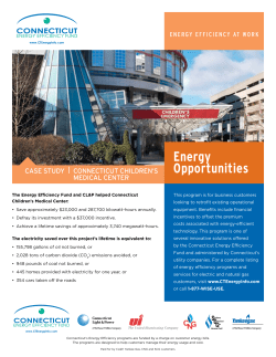


© Copyright 2025