
Document 364761
October 27, 2014
7 (d)
z
0
-en
-
( .)
Si necesita ayuda para comprender esta informacion, por favor /lame
503-588-6173
DECISION OF THE PLANNING COMMISSION
COMPREHENSIVE PLAN CHANGE/ZONE CHANGE CASE NO. CPC-ZC14-05
w
APPLICATION NO.: 14-114860-ZO & 14-114861-ZO
u.
0
REQUEST: A consolidated Comprehensive Plan Map Amendment and Zone
Change for portions of a property located near the intersection of 12th Street SE and
McGilchrist Street SE.
·
c
w
-1(.)
0
z
NOTICE OF DECISION DATE:
OCTOBER 9, 2014
The applicant proposes to change the Salem Area Comprehensive Plan (SACP)
Map designation from Single Family Residential to Commercial, and to change the
zone district from PA (Public Amusement) to CO (Commercial Office) for a strip of
land approximately 4,758 square feet in size at the northern perimeter of the
property. The applicant also proposes to change the SACP Map designation from
Single Family Residential to Commercial and the zone district from RS (Single
Family Residential) to CO for a strip of land approximately 7,986 square feet in size
at the western perimeter of the property. The subject property is approximately 1.31
acres in size and located at 1130 McGilchrist Street SE (Marion County Assessor's
Map and Tax Lot number: 073W34DA0100).
APPLICANT: BOULDER CREEK LLC
LOCATION: 1130 MCGILCHRIST ST SE
CRITERIA:
Salem Revised Code Chapters 64 and 265
DECISION:
The Planning Commission adopted the facts and findings of the staff report and
APPROVED, by resolution, the following actions forComprehensive Plan Change I
Zone Change 14-05 on property consisting of the previously-vacated rights-of-way at the
north and west perimeters of the property, and zone change for same from PA (Public
Amusement) and RS (Residential Single Family) to CO (Commercial Office) for a
property located at 1130 McGilchrist Street SE (Marion County Assessor's map and tax
lot number 073W34DA0100).
A. That the Salem Area Comprehensive Plan (SACP) map designation change
request for the subject portions of the property from Single Family Residential to
Commercial be GRANTED.
B. That the zone change request for the subject portions of the property from RS
(Single Family Residential) to CO (Commercial Office) and from PA (Public .
Amusement) to CO be GRANTED.
VOTE:
Yes
5
No 0
Absent 2 (Guyer, Palmateer)
A copy of the decision is attached.
Application Deemed Complete:
Public Hearing Date:
Notice of Decision Mailing Date:
Decision Effective Date:
State Mandate Date:
September 2. 2014
October 7. 2014
October 9. 2014
October 25. 2014
December 31. 2014
Case Manager: Chris Green, cgreen@cityofsalem.net
This decision is final unless written appeal from an aggrieved party is filed with the City
of Salem Planning Division, Room 305, 555 Liberty Street SE, Salem OR 97301, no
later than 5:00 p.m., October 24, 2014. Any person who presented evidence or
testimony at the hearing may appeal the decision. The notice of appeal must contain
the information required by SRC 300.1 020 and must state where the decision failed to
conform to the provisions of the applicable code section, SRC Chapters 64 and 265.
The appeal must be filed in duplicate with the City of Salem Planning Division. The
appeal fee must be paid at the time of filing. If the appeal is untimely and/or lacks the
proper fee, the appeal will be rejected. The City Council will review the appeal at a
public hearing. After the hearing, the City Council may amend, rescind, or affirm the
action, or refer the matter to staff for additional information.
The complete case file, including findings, conclusions and conditions of approval, if
any, is available for review at the Planning Division office, Room 305, City Hall, 555
Liberty Street SE, during regular business hours.
http:l/www.cityofsalem.net/planning
CPC-ZC 14-05
Page 2
October 9, 2014
I
FOR ME:"' riNG OF: October 7, 2014
AGENDA ITEM NO.: 6.2
A. I
TO:
Planning Commission
FROM:
Lisa Anderson-Ogilvie,
STAFF:
Christopher Green, Planner II
HEARING DATE:
October 7, 2014 •
APPLICATION:
Comprehensive Plan/Change Zone Change 14-05
LOCATION:
1130 McGilchrist Street SE
SIZE:
Affected areas are 4,758 square feet and 7,986 square feet
within a lot totaling 1.31 acres in size
REQUEST:
Comprehensive Plan Map change from Single Family
Residential to Commercial for portions of previously-vacated
rights-of-way at the north and west perimeters of the
property, and zone change . for same from PA (Public
Amusement) and RS (Residential Single Family) to CO
(Commercial Office) for a property located at 1130
McGilchrist Street SE (Marion County Assessor map and tax
lot number 073W34DA01 00).
APPLICANT:
Boulder Creek, LLC
APPROVAL CRITERIA:
Comprehensive Plan Amendment: Salem Revised Code, Ch.
64
_
Urb~l~~n~~mi~rator
A
·
. •
(}·
\\,
-
Zoning Map Amendment: Salem Revised Code, Ch. 265
RECOMMENDATION:
APPROVE
APPLICATION PROCESSING:
Subject Application
On August 27, 2014 Boulder Creek, LLC filed an application for a Comprehensive Plan
. Change and Zone Change to change the Comprehensive Plan Map designation of portions of
the subject property from Single Family Residential to Commercial, and to change the zoning
of same from PA (Public Amusement) and RS (Single Family Residential) to CO (Commercial
Office). The application was deemed complete for processing on September 2, 2014.
120-Day Requirement
Amendments to an acknowledged Comprehensive Plan are not subject to the 120-day rule
(Oregon Revised Statutes [ORS] 227 .128)
I
Comprehensive Plan I Zone (;,.dnge No. CPC-ZC14-05
1130 McGilchrist Street SE
Planning Commission Meeting of October 7, 2014
Page 2
Public Notice
1. Notice of the proposed Comprehensive Plan Change and Zone Change was
distributed to City departments and public and private service providers on September
2, 2014 (Attachment 1).
2. Notice of the public hearing was mailed to the owners of all property within 250 feet of
the subject property on September 2, 2014 (Attachment 1).
3. The property was posted in accordance with the posting provision outlined in SRC
300.620.
4. State law (ORS 197.610) and SRC 300.602(b)(1) require the City to provide the
Oregon Department of Land Conservation and Development (DLCD) a minimum 35day notice when an applicant or the City proposes an amendment to an acknowledged
Comprehensive Plan or land use regulation or to adopt a new land use regulation. The
City sent notice of this proposal to DLCD on August 29, 2014.
Background Information
The subject property is approximately 1.31 acres in size and is currently vacant. The
immediate vicinity includes a wide variety of uses, including retail, office, and auto services
buildings along the commercial corridor formed by 1z!h Street and 131h Street to the east,
Salem-Keizer School District athletic fields to the north at Gilmore Field, multifamily housing
to the south, and a wooded hillside providing a buffer from single family housing to the west.
Immediately to the northeast, the applicant is in the process of constructing a 14,300 square
foot office building at 2485 1zlh Street SE, called Boulder Creek North.
The statement submitted by the applicant includes a detailed discussion of the various.
transactions, land use changes, and development plans that have necessitated the subject
proposal. The present applicant, Boulder Creek, LLC, has owned two adjoining properties
just west of the intersection of McGilchrist Street SE and 1zlh Street SE for a number of
years. The two properties are map 07-3W-34DA Tax Lot 900 and 1000, addressed as 1130
McGilchrist Street SE and 2500 121h Street SE, respectively. Portions of Tax Lot 1000 are the
subject of the present Comprehensive Plan Map Amendment/Zone Change request.
For the purposes of this report, the basic sequence of events is summarized as follows:
1) In October 2006, Boulder Creek, LLC, received approvals for a Comprehensive Plan
Map Amendment and two zone changes for Tax Lots 900 and 1000 (CPC-ZC06-09).
In part, the approval changed the Comprehensive Plan Map designation for Tax Lot
1000 from Multiple Family Residential to Commercial and changed the zoning from
RM2 to CO.
2) At the same time, Boulder Creek, LLC petitioned the City to vacate unopened sections
of McGilchrist Street and Bluff Avenue adjacent to Tax Lots 900 and 1000 in order to
use the additional land for access driveways and parking for a proposed office
Comprehensive Plan I Zone Cmdnge No. CPC-ZC14-05
1130 McGilchrist Street SE
Planning Commission Meeting of October 7, 2014
Page 3
building. The vacations were granted in 2007, and the applicant paid an "assessment
of special benefit" for each vacated portion.
3) Consistent with the procedure for vacation of public rights-of-way, the vacated sections
were split into two halves, with each half accruing to the adjacent property. The
accrued halves also assume the Comprehensive Plan designations and zoning of the
bordering properties.
4) In addition to the halves of the rights-of-way which accrued to Tax Lots 900 and 1000,
Boulder Creek, LLC purchased the opposite halves, which had accrued to the adjacent
properties as part of the right-of-way vacation process. Boulder Creek replatted
several commonly-owned properties to incorporate these opposite halves (REP13-05),
but those portions retained the Comprehensive Plan designation and zoning of the
adjacent properties.
As a result, Tax Lot 1000 is designated as "Commercial" and zoned CO, except for the rightof-way halves which accrued to adjacent properties. The current zoning of the remnant strips
of land, PA on the north and RS on the west, would preclude the applicant from including
them in a commercial development on the property.
Summary of Requested Action
The applicant is requesting an amendment to the Salem Area Comprehensive Plan (SACP)
Map to change the Comprehensive Plan Map designation for portions of previously-vacated
right-of-way at the north and west perimeters of the property from Single Family Residential
to Commercial and the zone district of the same portions of the property from RS (Single
Family Residential) and PA (Public Amusement) to CO (Commercial Office). The change
would allow contiguous development of a commercial office building on commonly-owned
Tax Lots 900 and 1000. The applicant's statement summarizing the request and addressing
compliance with the required Comprehensive Plan Map amendment and zone change
approval criteria is included as Attachment 2.
Neighborhood Association Comments
The subject property is located within the South Central Association of Neighbors (SCAN)
and adjacent to the Southeast Salem Neighborhood Association (SESNA) and the
Morningside Neighborhood Association.
Notification was sent to the neighborhood
associations on September 17, 2014. As of the date of this staff report, neighborhood
associations had not submitted written comments.
Public Comments
All property owners within 250 feet of the subject property were mailed notification of the
proposed partition. Two nearby property owners submitted comments .on the proposal.
Tree Removal: One comment expressed concern that an Oregon White Oak was removed
Comprehensive Plan I Zone C,dnge No. CPC-ZC14-05
1130 McGilchrist Street SE
Planning Commission Meeting of October 7, 2014
·
Page 4
from the site in the summer of 2014.
Staff Response: Oregon White Oaks are included in the definition of significant trees (SRC
808.030) and may only be removed pursuant to a Tree and Vegetation Removal Permit. The
applicant submitted an arborist report indicating the hazardous condition of the tree. Planning
staff and the Urban Forester reviewed the report and issued a Tree and Vegetation Removal
Permit (Case No. TRP14-05) for the subject tree in June 2014.
Sidewalks: One comment expressed concern that no sidewalks had been installed along the
1ih Street frontage of an office building developed just to the north of the subject property
(Boulder Creek North). The comment stated that a sidewalk along the frontage of the
property to the north would be relevant to the subject application because of its contribution
to the overall sidewalk network in the vicinity of the site.
Staff Response: The portion of right-of-way referenced in the comment is not adjacent to the
subject portions of Tax Lot 1000 or the contiguous site of the applicant's conceptual
development plan for Tax Lots 900 and 1000. The developer of Boulder Creek North paid a
fee in-lieu to mitigate for impacts to the transportation system, including funding for a portion
of the costs of proposed improvements on 1ih Street SE. A project to reconstruct McGilchrist
Street SE to a 3-lane standard beginning at its intersection at 1ih Street SE and revise
signals at the intersection identified as a committed street improvement project within the
Salem Transportation System Plan. 1 Pursuant to SRC 66.595, the Director of Public Works
found that the fee-in-lieu of construction was appropriate because if the developer
constructed their portion of the improvement it would have impeded the construction of the
remaining portions of the full public improvement on 1ih Street, which extend beyond the
property frontage and include a traffic signal.
City Department Comments
Public Works Department (Development Services and City Traffic Engineer) - The Public
Works Department, Development Services Section, reviewed the proposal and submitted
comments (see Attachment 5)
Salem Police Department - reviewed the proposal and indicated that they have no specific
comments on this case.
Salem Urban Forester - reviewed the proposal and indicated that they have no specific
comments on this case.
Public and Private Service Provider Comments
Portland General Electric (PGE) reviewed the proposal and submitted standard comments
indicating that development costs are determined by current tariff and service requirements
and that a 10-foot public utility easement (PUE) is required on all front street lots.
1
See Salem Transportation System Plan, project #116.
Comprehensive Plan I Zone C!odnge No. CPC-ZC14-05
1130 McGilchrist Street SE
Planning Commission Meeting of October 7, 2014
Page 5
Salem Area Comprehensive Plan (SACP) Designation
The Salem Area Comprehensive Plan (SACP) map designates the majority of the subject
property as "Commercial." The Salem Comprehensive Policies Plan describes the intent of
the Commercial designation as providing for shopping and service opportunities, including
"regional shopping facilities, community and neighborhood shopping and service facilities,
convenience stores, commercial offices, and specialized shopping and service facilities."
The two portions of the property considered in the proposed Comprehensive Plan Map
change are designated as "Single Family Residential" as a result of first accruing to abutting
Single Family Residential properties through the right-of-way vacation process.
The Comprehensive Plan designations of surrounding properties include:
North:
(Gilmore Field) "Single Family Residential"
South:
(Across Cannon Street SE) "Multiple Family Residential"
East:
"Commercial"
West:
"Single Family Residential"
Relationship to the Urban Service Area
The subject property is located within the City's Urban Service Area (USA); therefore, an
Urban Growth Area Development Permit is not required for development of the property.
Components of the Comprehensive Plan
The Salem Area Comprehensive Plan is the long-range plan for guiding development in the
Salem urban area. The overall goal of the plan is to accommodate development in a timely,
orderly, and efficient arrangement of land uses and public facilities and services that meets
the needs of present and future residents of the Salem urban area. Many different documents
and maps, when taken together, comprise the Salem Area Comprehensive Plan.
Salem Transportation System Plan (TSP): The TSP uses a Street Classification System to
determine the functional classification of each street within the City's street system. The
subject property is located on Cannon Street SE, which is designated as a local street.
Cannon Street SE intersects with 1ih Street SE approximately 250 feet southeast of the
subject property. At this location, 12th Street SE is designated as a Major Arterial. The
abutting property to the east, under common ownership, has frontage on 12th Street SE.
SCAN Neighborhood Plan: The subject property is within the South Central Association of
Neighbors (SCAN). In addition, the boundaries of the Morningside Neighborhood Association,
the Southeast Salem Neighborhood Association (SESNA) and SCAN converge within a few
feet of the northeast corner of the subject property.
SCAN, SESNA, and Morningside are City-recognized neighborhood associations. The
Morningside Neighborhood Association has a neighborhood plan, which was adopted by the
I
Comprehensive Plan I Zone Cto"nge No. CPC-ZC14-05
1130 McGilchrist Street SE
Planning Commission Meeting of October 7, 2014
Page 6
Salem City Council in 2014. Although the subject property is located just outside of the
boundary of the Morningside Neighborhood Association, Tax Lot 900, under common
ownership and part of the .applicant's preliminary site plan for a contiguous development, is
within the neighborhood. The proposal is consistent with Morningside Neighborhood Plan
Policy 5.3, which encourages commercial uses in several commercial zones throughout the
neighborhood, including along 1ih and 13th Streets. The proposal vvould consolidate the Plan
Map designation and zoning of the subject property as Commercial/CO, consistent with
Policy 5.3.
·Zoning
The majority portion of the subject property is zoned CO (Commercial Office); the portions of
land subject to the proposed zone change are zoned PA (Public Amusement) on the north
perimeter and RS (Single Family Residential) on the western perimeter of the subject
property. The zoning of surrounding properties is described as follows:
North:
(Gilmore Field) PA (Public Amusement)
South:
(Across Cannon Street SE) RM2 (Multiple Family Residential)
East:
CR (Retail Commercial)
West:
RS (Single Family Residential)
Existing Site Conditions
The subject property consists of a single, undeveloped lot approximately 1.31 acres in size.
The lot slopes moderately downward from southwest to northeast with an elevation change of
approximately 18 feet. Grass covers the majority of the site, with several evergreen and
deciduous trees on the western and northern boundaries of the property.
Circulation and Access: A portion of the south boundary of the property has frontage on
Cannon Street SE. The applicant also owns Tax Lot 900, situated between Tax Lot 1000 and
1ih Street SE. The concept site plan submitted by the applicant shows an office building with
parking lot and access driveways encompassing both lots, with on access to Cannon Street
SE and primary access to 12th Street SE. The adjacent portion of Cannon Street SE is
designated as a local street in the Salem Transportation System Plan (TSP). Cannon Street
SE intersects with 1ih Street SE approximately 250 feet southeast of the subject property. At
this location and along the frontage of Tax Lot 900, 1ih Street SE is designated as a Major
Arterial. Any additional necessary street improvement or right-of-way requirements will be
addressed at such time that new development is proposed on the site through the Site Plan
Review Process.
Trees: The City's tree preservation ordinance protects heritage trees, significant trees
(including Oregon White Oaks with a diameter-at-breast-height of 24 inches or greater), trees
and vegetation within riparian corridors, and trees on lots or parcels greater than 20,000
square feet. Because Clark Creek abuts the subject property to the north, a riparian corridor
Comprehensive Plan I Zone c,,ange No. CPC-ZC14-05
1130 McGilchrist Street SE
Planning Commission Meeting of October 7, 2014
Page 7
is present on the site. The riparian corridor is measured 50 feet horizontally from the top of
bank on each side of the waterway.
Any development, of the subject property must comply with the tree preservation
requirements of SRC Chapter 808 (Preservation of Trees and Vegetation). Pursuant to the
City's tree preservation requirements, no heritage trees, significant trees, or riparian corridor
trees or riparian corridor native vegetation shall be removed.
Wetlands: According to the Salem Keizer Local Wetland Inventory (LWI) there are no
mapped wetlands on the subject property.
Landslide Hazards: The lot slopes downward to the northeast of the property, with a hill
rising just to the east of the property and the gully carved by Clark Creek running just beyond
the north property line. According to the City's adopted landslide hazard susceptibility maps,
there is an area of mapped landslide hazard susceptibility points located in the north-central
portion of the property as well as the northwest and southwest corners. Based on the point
value associated with the' land, a geologic assessment will be required if a regulated
development activity is proposed in the mapped landslide hazard area.
Site Plan
A site plan is not required as part of a Comprehensive Plan Map Amendment/Zone Change
application. The applicant's submittal includes a preliminary site plan for a proposed office
building that would be developed on the subject property and abutting property to the east.
Although the site plan illustrates how the areas to be rezoned would be used as part of the
proposed office building, the applicant has not requested development approval as part of the
subject application (Attachment 4).
Applicant Submittal Information:
Requests for Minor Comprehensive Plan Changes and zone changes must include a
statement addressing each applicable approval criterion and standard. The applicant
submitted such statements and proof, which are included in their entirety as Attachment 2 to
this staff report. Staff utilized the information from the applicant's statements to evaluate the
applicant's proposal and to compose the facts and findings within the staff report.
FINDINGS APPLYING THE APPLICABLE SALEM REVISED CODE CRITERIA FOR A
COMRPREHENSIVE PLAN AMENDMENT
Salem Revised Code (SRC) 64.025(e)(2) establishes the approval criteria for Comprehensive
Plan Map amendments. In order to approve a quasi-judicial Plan Map amendment request,
the decision-making authority shall make findings of fact based on evidence provided by the
applicant that demonstrates satisfaction of all of the applicable criteria. The applicable criteria
are shown below in bold print. Following each criterion is a finding relative to the amendment
requested.
SRC 64.025(e)(2)(A): The Minor Plan Map Amendment is justified based on the
'
Comprehensive Plan I Zone c, .dnge No. CPC-ZC 14-05
1130 McGilchrist Street SE
Planning Commission Meeting of October 7, 2014
Page 8
existence of one of the following:
(i)
Alteration in Circumstances. Social, economic, or demographic patterns
of the nearby vicinity have so altered that the current designations are no
longer appropriate.
(ii)
Equally or Better Suited Designation. A demonstration that the proposed
designation is equally or better suited for the property than the existing
designation.
(iii)
Conflict Between Comprehensive Plan Map Designation and Zone
Designation. A Minor Plan Map Amendment may be granted where there is
conflict between the Comprehensive Plan Map designation and the zoning
of the property, and the zoning designation is a more appropriate
designation for the property than the Comprehensive Plan Map
designation. In determining whether the zoning designation is the more
appropriate designation, the following factors shall be considered:
(aa)
Whether there was a mistake in the application of a land use
designation to the property;
(bb) Whether the physical characteristics of the property are better
suited to the uses in the zone as opposed to the uses permitted by the
Comprehensive Plan Map designation;
(cc)
Whether the property has been developed for uses that are
incompatible with the Comprehensive Plan Map designation; and
(dd) Whether the Comprehensive Plan Map designation is compatible
with the surrounding Comprehensive Plan Map designations.
Finding: The proposal is justified based on (ii). The Single Family Residential designation of
the subject portions of Tax Lot 1000 creates a split designation on the lot, thereby preventing
consistent development across the property as a whole. The subject portions, which make up
approximately 22% of the total size of the lot, are unusable for the purposes provided for by
that designation. The limited size and narrow configuration of the strips of land do not provide
sufficient land for residential development or any other practical use, and can only be
accessed through the portion of the lot designated as Commercial. The lot abuts another
Commercial-designated property to the east, which. is under common ownership and includes
frontage along 1z!h Street SE. The proposal meets this criterion.
SRC 64.025(e)(2)(8): The property is currently served, or is capable of being served,
with public facilities and services necessary to support the uses allowed by the
proposed plan map designation;
Finding: The 8-inch G-O waterline and 21-inch sewer main in 12th Street SE are adequately
sized to handle commercial redevelopment of the area. An existing 10-inch public storm main
;
Comprehensive Plan I Zone c,,dnge No. CPC-ZC14-05
1130 McGilchrist Street SE
Planning Commission Meeting of October 7, 2014
Page 9
bisects the subject property and Clark Creek runs along the north property line. Therefore,
water, sewer, and storm infrastructure are available within surrounding streets/areas and
appear to be adequate to serve future uses. Tax Lot 1000 has frontage on Cannon Street SE,
which provides direct access to 1zlh Street SE, designated as a major arterial in the Salem
Transportation System Plan (TSP). Cherriots bus line #6 provides service along the 12th
Street/131h Street couplet, and both 1zlh Street and 13th Street include bike lanes within their
rights-of-way. Site-specific infrastructure requirements will be addressed in the Site Plan
Review process in SRC Chapter 220. The proposal meets this criterion.
SRC 64.025(e)(2)(C): The proposed plan map designation provides for the logical
urbanization of land;
Applicant Statement: The property is within a highly developed part of the city. The parent
parcel was designated Commercial/CO to provide for a proposed office use. The two rights of
way were vacated for inclusion with the use of the parent parcel. The current designation is a
remnant left from the right of way vacation procedure. As currently designated the two strips
do not provide for logical urbanization. All necessary public facilities and services are
available to support the planned development and use of the land. Based on these factors,
changing the plan map designation to match the parent parcel provides for the logical
urbanization of the land.
Staff Response: Staff concurs with the applicant's statement. The split zoning of the subject
property presents a barrier to the logical urbanization of Tax Lots 900 and 1000, which the
proposal would alleviate. The applicant is in the process of developing an office building on
the adjacent property to the north, and the concept site plan for Tax Lots 900 and 1000 show
a proposed office building consistent with development patterns along the corridor.
Natural features also buffer the subject property from non-commercial land uses in the
vicinity. North of the property boundary, Clark Creek separates Tax Lot 1000 from Gilmore
Field. Just beyond the west property line, a wooded hillside rises approximately 70 feet
between the property line and single family residences above. As a result, the subject
property and 1z!h Street commercial corridor is effectively separated from these adjacent
uses. Staff finds that the proposal meets this criterion.
SRC 64.025(e)(2)(D): The proposed land use designation is consistent with the Salem
Area Comprehensive Plan and applicable Statewide planning goals and administrative
rules adopted by the Department of Land Conservation and Development; and
Finding: The applicable Goals and Policies of the Comprehensive Plan are addressed as
follows:
Comprehensive Land Use Map, Intent (Page 3, Salem Comprehensive Policies Plan):
The intent of the Salem Area Comprehensive Plan is to project a goal: the most
desirable pattern of land use in the Salem area. This pattern, as represented on
I'
Comprehensive Plan I Zone C;,dnge No. CPC-ZC 14-05
1130 McGilchrist Street SE
Planning Commission Meeting of October 7, 2014
Page 10
the Comprehensive Plan Map, indicates areas appropriate for different types of
land use. The pattern takes into consideration the transportation network, the
location of public facilities and utility systems, and the needs of the people which
are important to the creation and maintenance of a healthful and pleasing urban
environment.
To ensure that the anticipated urban land use needs are met, the Plan Map
demonstrates a commitment that land for a wide variety of uses will be available at
appropriate locations as needed. There are two approaches to achieving this
commitment. One approach is the rezoning of land in quantities sufficient to
accommodate land use demands identified for the planning period. Another
approach is through the phased provision of land over time, through annexation
and rezoning in response to demand for specific land uses . ...
It is the later approach that the Salem Area Comprehensive Plan has taken, thus
the land use pattern that is shown on the map recognizes the zoning that has
developed over time, with general designations of the land uses that are expected
to be developed as a result of (1) demand, (2) the plan policies and the intent
statements, and (3) implementing regulations and processes. This plan recognizes
that the land use and zoning is expected to change during the time span of the plan
as conditions change.
Response: The proposal to change the Comprehensive Plan Map designation for the subject
portions of the property would resolve the split designation of the lot. The proposal would
address the changing conditions resulting from the 2007 vacation of rights-of-way and
subsequent land use designations applied to those portions of the property. By providing a
consistent Comprehensive Plan Map designation across the property, the change would
respond to demand for a specific land use (the commercial office development shown in the
applicant's preliminary site plan) that was previously anticipated when the parent portion of
the property was designated Commercial. For these reasons the proposal is consistent with
the intent and methodology of the plan.
Urban Growth Policies (Page 13, Salem Comprehensive Policies Plan):
a. To contain urban development within planned areas where basic services such
as sewers, water, facilities, police and fire protection can be efficiently and
economically provided.
b. To conserve resources by encouraging orderly development of land.
c. To preserve and enhance the livability of the area.
d. To use public facilities and services as a framework for urban development.
Response: The public facilities and service needs for the subject property would be provided
at the time of development of the site. All public services and utilities are available in the
vicinity of the subject property including water, sewer, storm drainage, streets, bike lanes,
Comprehensive Plan I Zone C11dnge No. CPC-ZC14-05
1130 McGilchrist Street SE
Planning Commission Meeting of October 7, 2014
Page 11
sidewalks, fire and police protection, public transit (Cherriots bus line 6), electricity and
telephone, and solid waste disposal. The proposed Comprehensive Plan Map amendment
with concurrent Zone Change is consistent with these policies.
Salem Urban Area Goals and Policies, General Development Policy 7, Optimal Use of the
Land (Page 25, Salem Comprehensive Policies Plan):
Structures and their siting in all residential, commercial and industrial
developments shall optimize the use of land. The cumulative effect of all new
residential development in the Salem urban area should average 6. 5 dwelling units
per gross acres of residential development. Development should minimize adverse
alteration of the natural terrain and watercourses, the potential of erosion and
adverse effects upon the existing topography and soil conditions.
Response: The Comprehensive Plan Map Amendment would provide a uniform Commercial
designation for the currently undeveloped subject property, which is located adjacent to
largely developed commercial corridor on 1zih Street SE. The uniform Plan Map designation
would facilitate development of an infill site without the need to clear and grade other more
environmentally sensitive land within the urban area.
Salem Urban Area Goals and Policies, Growth Management Goal (Page 28, Salem
Comprehensive Policies Plan):
To manage the growth in the Salem urban area through cooperative efforts of the
City of Salem and Marion and Polk Counties, to insure the quality of life of present
and future residents of the area, and to contain urban development to preserve
adjacent farm land.
Response: The necessary public facilities, services and utilities are already in place and
providing service to the subject property. Expansions of the services and systems may be
needed as a result of the planned development of the remainder of the site that will be made
possible by the proposed Comprehensive Plan Map amendment with concurrent Zone
Change. The existence and availability of public services, facilities and utilities to the property
fulfills this goal.
Salem Urban Area Goals and Policies, Residential Development Goal (Page 32, Salem
Comprehensive Policies Plan):
To promote a variety of housing opportunities for all income levels and an
adequate supply of developable land to support such housing.
Response: The portions of the property designated as Single Family Residential are
undeveloped and do not currently provide housing units. The size, shape, and configuration
of these strips of land along the perimeters of the property preclude residential development
that could meet minimum regulatory and practical requirements. Accordingly, the subject
portions of the property cannot implement the Residential Development goal as intended by
Comprehensive Plan I Zone Ciodnge No. CPC-ZC14-05
1130 McGilchrist Street SE
Planning Commission Meeting of October 7, 2014
Page 12
the Single Family Residential designation, and an amendment to designate those portions as
Commercial would not diminish the variety of housing opportunities or supply of developable
land to support housing.
Salem Urban Area Goals and Policies, Commercial Development Goal (Page 35, Salem
Comprehensive Policies Plan):
To maintain and promote the Salem urban area as a commercial center for the
Marion-Polk County metropolitan area.
Response: The proposal would provide a uniform Commercial designation and CO
·'
(Commercial Office) zoning across Tax Lot 1000 and the commonly-owned abutting property
to the east. As a result, the proposal would allow commercial development on these two
undeveloped lots. The lots are within an established commercial corridor, with 1z!h Street SE,
131h Street SE, and McGilchrist Street SE providing arterial access to the site from all parts of
the Salem urban area as well as the Marion-Polk County metropolitan area. By facilitating
commercial development that is consistent with the surrounding corridor and regionally
accessible, the proposal is consistent with this goal.
Salem Urban Area Goals and Policies, Economic Development Goal (Page 36, Salem
Comprehensive Policies Plan):
Strengthen the economic base of the Salem area to sustain the economic growth
necessary to provide adequate employment opportunities and maintain community
livability.
Response: The proposal would facilitate commercial development of two undeveloped lots.
The applicant has provided a concept plan for an office building on the site, consistent with
the proposed zone change to CO (Commercial Office). Office or other commercial
development on the site would provide space for employment opportunities in an established
and easily accessible commercial corridor.
Finding: The applicable Statewide Planning Goals are addressed as follows:
Goal 1 - Citizen Involvement
The affected property owners were notified of the proposed change.
A public hearing notice was mailed to the affected property owners, all property owners within
250 feet of the subject property and to the adjacent neighborhood associations. This satisfies
Citizen Involvement described in Goal 1.
Goal 2 - Land Use Planning
The City has complied with the Goal requirements for establishing and maintaining a land use
planning process. The Oregon Land Conservation and Development Commission has
acknowledged the Salem Area Comprehensive Plan to be in compliance with the Statewide
Comprehensive Plan I Zone Cr,dnge No. CPC-ZC14-05
1130 McGilchrist Street SE
Planning Commission Meeting of October 7, 2014
Page 13
Planning Goals.
Goal 5 - Open Spaces, Scenic and Historic Areas, and Natural Resources
No resources have been identified or designated on the subject property under Goal 5.
Although the subject portion on the north perimeter of the property is zoned PA (Public
Amusement), it has never been used as a park and is not designated as park land in the
SACP or Salem Comprehensive Park System Master Plan.
Goal 6 - Air, Water and Land Resources Quality
Applicant Statement: The redesignation of the property will have no significant affects on
air, water or land resource quality. The subject property is part of a larger property that is
already designated and zoned for commercial office use. All required public services and
utilities are available to the property. Water will be supplied to the site by the City water
system. There will be no withdrawal of subsurface groundwater resources. Waste water from
the property will be discharged into the City sewer system. Storm water runoff will be
collected and removed by the City storm drainage system. Designating the subject property
as proposed will not itself allow a change in the use of the parent parcel, and therefore will
have no impacts on air quality.
The overall property is flat. A steep slope is to the west is not part of the property and
development on the site will not intrude onto the slope. There are no identified adverse
impacts to the land.
No significant adverse impacts to the quality of the air, water, or land are identified as a result
of the proposed change in designation.
Staff Response: Staff concurs with the applicant's statement. Eventual build-out of vacant
properties along heavily developed commercial corridors is expected. The proposal would not
intensify the development allowed on the subject property or otherwise result in adverse
impacts to air, water, or land resources quality. Staff finds that the proposal is consistent with
Goal6.
Goal 7 - Areas Subject to Natural Disasters and Hazards
Applicant Statement: The steep slope located to the west of the vacated Bluff Avenue right
of way includes indicated landslide hazard areas. City data indicate a landslide
hazard in the
I
northwest corner of the subject site, but development on the parent parcel will not be on the
slope or within the indicated hazard area. This is the only potential natural hazard that has
been identified that is specific to the site.
Finding: Staff concurs with the applicant's statement and finds that the proposal is consistent
with Goal?.
Goal 8 - Recreational Needs
I
Comprehensive Plan I Zone Crodnge No. CPC-ZC14-05
1130 McGilchrist Street SE
Planning Commission Meeting of October 7, 2014
Page 14
Applicant Statement: A small part of the former right of way is zoned PA, which is applied to
park land. However, it is not designated for park or open space use by the Comp Plan. The
right of way is located across Clark Creek from the School District park, and it was never
used as park land. The site is not designated for recreational use and this Goal does not
apply.
Finding: The strip of land zoned PA is isolated from the remainder of Gilmore Field by Clark
Creek and cannot provide recreational opportunities due to its size and configuration. Staff
concurs with the applicant's statement and finds that the proposal is consistent with Goal 8.
Goal 9- Economic Development
Applicant Statement: The subject property is part of the parent parcel that will be developed
for commercial use. The property is along a major south Salem commercial corridor. The
subject property is currently vacant and unproductive. By developing the site the proposal will
improve the value and economic contribution of the property to the city. In this way the
proposal will contribute to the economic base of the urban area, which is consistent with this
Goal.
Finding: Staff concurs with the applicant's statement and finds that the proposal is consistent
with Goal9.
Goal10- Housing
Applicant Statement: The subject property is designated for single-family housing, but it
was formerly street right of way. It was not intended or available for housing. It is vacant and
there is no housing on the property. It is part of a larger property that is zoned CO .. No
housing opportunities will be affected by this proposal. There is an adequate supply of vacant
land designated for single-family housing within the urban area. Redesignating the subject
property for commercial use to match the parent parcel will have no effect on the City's ability
to provide single-family housing or to meet the requirements of this Goal.
Finding: Staff concurs with the applicant's statement. The subject portions of Tax Lot 1000
only total approximately 0.29 acres in size and cannot provide housing opportunities based
on size and configuration. The proposal would not have an impact on the ability of the City to
provide for its projected housing needs. The proposal meets the requirements of Goal10.
Goal 11 - Public Facilities and Services
All necessary public services and utilities including water, sewer, storm drainage, streets, fire
and police protection, public transit,· electricity, telephone, and solid waste disposal, are
currently available. The provision of public facilities and services are adequate for potential
commercial uses on the subject property. Therefore, the proposal meets the requirements of
Goal11.
Goal12- Transportation
I
Comprehensive Plan I Zone C11ange No. CPC-ZC14-05
1130 McGilchrist Street SE
Planning Commission Meeting of October 7, 2014
Page 15
Goal 12 is implemented by the Transportation Planning Rule (TPR). In summary, the TPR
requires local governments to adopt Transportation System Plans (TSPs) and requires local
governments to consider transportation impacts resulting from land use decisions and
development. The key provision of the TPR related to .local land use decisions is Oregon
Administrative Rule (OAR) 660-012-0060. This provision is triggered by amendments to
comprehensive plans and land use regulations that "significantly affect" a surrounding
transportation facility (road, intersection, etc.). Where there is a "significant effect" on a
facility, the local government must ensure that any new allowed land uses are consistent with
the capacity of the facility. In the context of a site-specific comprehensive plan change
request, such as this proposal, a "significant effect" is defined under Oregon Administrative
Rule (OAR) 660-012-0060(1) as either an amendment that "allows types or levels of land
uses which would result in levels of travel or access which are inconsistent with the functional
classification of a transportation facility," or an amendment that would "reduce the
performance standards of an existing or planned facility below the minimum acceptable level
identified in the TSP."
The applicant for a comprehensive plan change is required to submit a Transportation
Planning Rule (TPR) analysis to demonstrate that their request will not have a "significant
effect" on the surrounding transportation system, as defined above. The applicant's Goal 12
analysis finds that no new impacts on the transportation system will be created because the
addition of remnant rights-of-way to the commercial-designated portions of the property
would not increase the allowed development intensity on the property. The City Traffic
Engineer has reviewed the TPR Analysis that was submitted by the applicant and agrees with
its findings. The proposed Comprehensive Plan Change and Zone Change will not have a
"significant affect" on the transportation system as defined by OAR 660-012-0060. The
proposal meets the requirements of Goal12.
Goal13- Energy Conservation
Applicant Statement: The property is located within the developed urban area. The
transportation system in this area is fully established and makes access to the property
direct, efficient, and convenient by motorized and non-motorized forms of transportation. The
property's location along a major travel route serves to reduce the vehicle miles travel to
reach the site, which conserves energy. In addition, new structures will be required to meet
the energy efficiency codes in effect at the. time of construction. For these reasons, the
project will serve to promote energy conservation and will be energy efficient.
Finding: Staff concurs with the applicant's statement and finds that the proposal is consistent
with Goal 13.
Goal14- Urbanization
This application does not affect urban growth areas, as the property has been within the City
of Salem for many decades. The change in land use designation from Residential to
i
Comprehensive Plan I Zone c,,dnge No. CPC-ZC14-05
1130 McGilchrist Street SE
Planning Commission Meeting of October 7, 2014
Page 16
Commercial is consistent with the surrounding commercial development on the 12th Street
SE/131h Street SE corridor. Therefore, staff finds that the proposal is consistent with Goal 14.
SRC 64.025(e)(2)(E): The amendment is in the public interest and would be of general
benefit.
Finding: The proposed Comprehensive Plan Map amendment from Single Family
Residential to Commercial is in the public interest and would be of general benefit because it
would alleviate the split land use designation and zoning, a situation that currently precludes
development of the site as a contiguous property. The proposal would also facilitate viable
use of the remnant portions of property, which due to their limited size cannot reasonably be
developed for any of the residential or recreational purposes for which they are currently
designated.lnvestment in the development of underutilized properties within existing
developed areas is in the public interest and of general benefit. The proposal satisfies this
criterion.
FINDINGS APPLYING TO THE APPLICABLE SALEM REVISED CODE CRITERIA FOR
THE ZONING MAP AMENDMENT
The following analysis addresses the proposed zone change for the subject portions of the
property from RS (Residential Single Family) to CO (Commercial Office) and from PA (Public
Amusement) to CO.
SRC Chapter 265.005 provides the criteria for approval for Quasi-Judicial Zone Changes. In
order to approve a quasi-judicial Zone Map amendment request, the review authority shall
make findings based on evidence provided by the applicant demonstrating that all the
following criteria and factors are satisfied. The extent of the consideration given to the various
factors set forth below will depend on the degree of impact of the proposed change, and the
greater the impact of a proposal on the area, the greater is the burden on the applicant to
demonstrate that, in weighing all the factors, the zone change is appropriate.
The applicable criteria and factors are stated below in bold print. Following each criterion is
a response and/or finding relative to the amendment requested. The applicant provided
justification for all applicable criteria (Attachment 2).
SRC 265.005(e)(1)(A). The zone change is justified based on one or more of the
following:
(i)
A mistake in the application of a land use designation to the property
(ii)
A demonstration that there has been a change in the economic,
demographic, or physical character of the vicinity such that the zone
would be compatible with the vicinity's development pattern.
(iii)
A demonstration that the proposed zone change is equally or better suited
'
Comprehensive Plan I Zone C1odnge No. CPC-ZC14-05
1130 McGilchrist Street SE
Planning Commission Meeting of October 7, 2014
Page 17
for the property than the existing zone. A proposed zone is equally or
better suited than an existing zone if the physical characteristics of the
property are appropriate for the proposed zone and the uses allowed by
the proposed zone are logical with the surrounding land uses.
Applicant's Statement: The proposed change in zones from RS and PA to CO is better
suited than the existing zones because the current zones are unusable for any beneficial
purpose. The subject property is physically appropriate for the proposed CO zone because it
is contiguous to the parent parcel, has the same physical characteristics, and presents no
obstacles or obstructions to development. The areas to be rezoned will be used for access
and parking in conjunction with the building planned for the street frontage. This is logical
because it will make use of vacant land that is part of contiguous ownership. The relationship
of the proposed development to the surrounding lands was considered in the previous zone
change to CO, and the uses in that zone were found to be logical with the surrounding uses.
Finding: As indicated by the applicant's statement, the request satisfies (iii). The overall site
that would be formed by Tax Lots 900 and 1000 is generally flat, not encumbered by
waterways, wetlands, or large amounts of vegetation. Mapped areas of landslide hazards are
generally confined to the perimeter of the property. The combined site would have frontage
on 1zlh Street SE, a major arterial characterized. by a variety of office, retail, and service uses.
The preliminary site plan submitted by the applicant shows a development consistent with
existing development patterns along the 1z!h Street corridor. The subject property is
effectively buffered from non-commercial land uses by natural features, including a wooded
hillside to the west and Clark Creek to the north. The proposal meets this criterion.
(A) If the zone change is City-initiated, and the change is for other than City-owned
property, the zone change is in the public interest and would be of general
benefit.
Finding: The proposal is not a City-initiated zone change. Therefore, this criterion does not
apply.
(B) The zone change conforms with the applicable provisions of the Salem Area
Comprehensive Plan.
(C) The zone change complies with applicable Statewide Planning Goals and
applicable administrative rules adopted by the Department of Land Conservation
and Development.
Findings addressing the Comprehensive Plan Change criterion SRC 64.025(e)(2)(D),
included earlier in this report, address the applicable provisions of the Salem Area
Comprehensive Plan and applicable Statewide Planning Goals and Oregon Administrative
Rules for this consolidated comprehensive plan change and zone change request. The
proposal satisfies this criterion.
Comprehensive Plan I Zone Cnange No. CPC-ZC14-05
1130 McGilchrist Street SE
Planning Commission Meeting of October 7, 2014
Page 18
(D) If the zone change requires a comprehensive plan change from an industrial use
designation to a non-industrial use designation, or from a commercial or
employment designation to any other use designation, a demonstration that the
proposed rezone is consistent with its most recent economic opportunities
analysis and the parts of the Comprehensive Plan which address the provision
of land for economic development and employment growth; or be accompanied
by an amendment to the Comprehensive Plan to address the proposed rezone;
or include both the demonstration and an amendment to the Comprehensive
Plan.
Finding: The proposed zone changes are from RS (Residential Single Family) to CO
(Commercial Office) and from PA.(Public Amusement) to CO. No industrial Comprehensive
Plan designations or zoning districts are involved in the proposal. Therefore, this criterion
does not apply.
(I::) The zone change does not significantly affect a transportation facility, or, if the
zone change would significantly affect a transportation facility, the significant
effects can be adequately addressed through the measures associated with, or
conditions imposed on, the zone change.
Finding: Cannon Street SE provides a direct link to 1z!h Street SE and the arterial network.
The conceptual site plan submitted by the applicant encompasses both Tax Lots 900 and
1000, with access for the proposed office development taken from both 1z!h Street and
Cannon Street. The driveway onto 1zlh Street would align with McGilchrist Street SE to form
a four-way intersection. The change in the Plan Map designation for the remnant portions of
this property would not cause a significant effect on the existing transportation system, or
result in a level of services decreasing to an unacceptable level. The applicant's analysis
indicates that no new impacts on the transportation system will be created would be created
by the Comprehensive Plan Map change or zone change. Staff concurs with the applicant's
analysis because the proposal would not increase the allowed development intensity of Lot
1000.
(F) The property is currently served, or is capable of being served, with public
facilities and services necessary to support the uses allowed in the proposed
zone.
Finding: Findings addressing the Comprehensive Plan Change criterion SRC
64.025(e)(2)(B), included earlier in this report, address the public facilities and services
available to support commercial uses allowed on the subject property. The proposal satisfies
this criterion.
RECOMMENDATION
Staff recommends that the Planning Commission adopt the facts and findings of the staff
i
Comprehensive Plan I Zone Cr,dnge No. CPC-ZC14-05
1130 McGilchrist Street SE
Planning Commission Meeting of October 7, 2014
Page 19
report and APPROVE, by resolution, the following actions for Comprehensive Plan Change I
Zone Change 14-05 on property consisting of the previously-vacated rights-of-way at the
north and west perimeters of the property, and zone change for same from PA (Public
Amusement) and RS (Residential Single Family) to CO (Commercial Office) for a property
located at 1130 McGilchrist Street SE (Marion County Assessor map and tax lot number
073W34DA01 00).
A. That the Salem Area Comprehensive Plan (SACP) map designation change request
for the subject portions of the property from Single Family Residential to Commercial
be GRANTED.
B. That the zone change request for the subject portions of the property from RS (Single
Family Residential) to CO (Commercial Office) and from PA (Public Amusement) to
CO be GRANTED.
Attachments:
1.
2.
3.
4.
5.
Public Hearing Notice & Vicinity Map
Applicant's Statement Addressing Approval Criteria
Public Works Department Comments
Applicant's Development Concept Plan
Zoning Map
Prepared by Christopher Green, Planner II
G:ICD\PlANNING\CASE APPLICATION Flies 2011-0n\CPC-ZC Comp
Plan Change-Zone Change\2014\3- Staff Reports\CPC-ZC14-05.cjg.docx
II
CITY~~
<......J MYOUR SERVICE
ATTACHMENT 1
HEARING NOTICE
LAND USE REQUEST AFFECTING THIS AREA
Audiencia Publica
Si necesita ayuda para compiender esta informacion, por favor /lame 503·588-6173
CASE NUMBER:
Minor Comprehensive Plan Map Amendment I Zone Change Case No.CPC-ZC14-05
AMANDA APPLICATION NO:
14-114860-ZO & 14-114861-ZO
HEARING INFORMATION:
PLANNING COMMISSION, TUESDAY, OCTOBER 7, 2014, 5:30P.M., Council
Chambers, Room 240, Civic Center
PROPERTY LOCATION:
1130 MCGILCHRIST ST SE, SALEM OR, 97302
OWNER:
BOULDER CREEK, LLC
APPLICANT:
BOULDER CREEK, LLC
DESCRIPTION OF
REQUEST:
A consolidated Comprehensive Plan Map Amendment and Zone Change for portions
of a property located near the intersection of 12th Street SE and McGIIchrist Street
SE.
The applicant proposes to change the Salem Area Comprehensive Plan (SACP) Map
designation from Single Family Residential to Commercial, and to change the zone
district PA (Public Amusement) to CO (Commercial Office) for a strip of land
approximately 4,758 square feet In size at the northern perimeter of the property. The
applicant also proposes to change the SACP Map designation from Single Family
Residential to Commercial and the zone district from from RS (Single Family
Residential) to CO for a strip of land approximately 7,986 square feet In size at the
western perimeter of the property. The subject property is approximately 1.31 acres in
size and located at 1130 McGIIchrlst Street SE (Marion County Assessor's Map and
Tax Lot number: 073W34DA0100).
CRITERIA TO BE
CONSIDERED:
COMPREHENSIVE PLAN MAP AMENDMENT
Pursuant to SRC 64.025(e)(2), the greater the impact of the proposed Minor Plan Map
Amendment, the greater the burden on an applicant to demonstrate that the criteria are
satisfied.
(A) A Minor Plan Map Amendment Is justified based on the existence of one of the
following criteria:
(i) Alteration In Circumstances. Social, economic, or demographic patterns of
the nearby vicinity have so altered that the current designations are no longer
appropriate.
(ii) Equally or Better Suited Designation. A demonstration that the proposed
designation Is equally or better suited for the property than the existing
designation.
(iii) Conflict Between Comprehensive Plan Map Designation and Zone
Designation. A Minor Plan Map Amendment may be granted where there is
a conflict between the Comprehensive Plan Map designation and the zoning
of the property, and the zoning designation Is a more appropriate designation
for the property than the Comprehensive Plan Map designation. In
determining whether the zoning designation is the more appropriate
designation, the following factors shall be considered:
(aa) Whether there was a mistake in the application of a land use
designation to the property;
(bb) Whether the physical characteristics of the property are better suited to
the uses In zone as opposed to the uses permitted by the
Comprehensive Plan Map designation;
(cc) Whether the property has been developed for uses that are
incompatible with the Comprehensive Plan Map designation; and
(dd) Whether the Comprehensive Plan Map designation is compatible with
the surrounding Comprehensive Plan Map designations.
(B) The property is currently served, or Is capable of being served, with public facilities
and services necessary to support the uses allowed by the proposed plan map
designation;
(C) The proposed plan map designation provides for the logical urbanization of land;
(D) The proposed land use designation is consistent with the Salem Area
Comprehensive Plan and applicable Statewide planning goals and administrative
rules adopted by the Department of Land Conservation and Development; and
(E) The amendment is In the public interest and would be of general benefit.
ZONE CHANGE
Pursuant SRC 265.005(e)(1):
(A) A quasi-judicial zone change shall be granted If all of the following criteria are met:
(i) A mistake in the application of a land use designation to the property;.
(II) A demonstration that there has been a change In the economic,
demographic, or physical character of the vicinity such that the proposed
zone would be compatible with the vicinity's development pattern; or
(Ill) A demonstration that the proposed zone is equally or better suited for the
property than the existing zone. A proposed zone Is equally or better suited
for the property than an existing zone if the physical characteristics of the
property are appropriate for the proposed zone and the uses allowed by the
proposed zone are logical with the surrounding land uses.
(B) If the zone change Is City-initiated, and the change Is for other than City-owned
property, the zone change is in the public Interest and would be of general benefit.
(C) The zone change complies with the applicable provisions of the Salem Area
Comprehensive Plan.
(D) The zone change complies with applicable Statewide Planning Goals and
applicable administrative rules adopted by the Department of Land Conservation
and Development.
(E) If the zone change requires a comprehensive plan change from an Industrial
designation to a non-industrial designation, or a comprehensive plan change from
a commercial or employment designation to any other designation, a
demonstration that the proposed zone change is consistent with the most recent
economic opportunities analysis and the parts of the Comprehensive Plan which
address the provision of land for economic development and employment growth;
or be accompanied by an amendment to the Comprehensive Plan to address the
proposed zone change; or include both the demonstration and an amendment to
the Comprehensive Plan.
(F) The zone change does not significantly affect a transportation facility, or, if the
zone change would significantly affect a transportation facility, the significant
effects can be adequately addressed through the measures associated with, or
conditions imposed on, the zone change.
(G) The property is currently served, or Is capable of being served, with public facilities
and services necessary to support the uses allowed by the proposed zone.
HOW TO PROVIDE
TESTIMONY:
HEARING PROCEDURE:
Any person wishing to speak either for or against the proposed request may do so in
person or by representative at the Public Hearing. Written comments may also be
submitted at the Public Hearing. Include case number with the written comments. Prior to
the Public Hearing, written comments may be filed with the Salem Planning Division,
Community Development Department, 555 Liberty Street SE, Room 305, Salem, Oregon
97301. Only those participating at the hearing, in person or by submission of written
testimony, have the right to appeal the decision.
The hearing will be conducted with the staff presentation first, followed by the applicant's
case, neighborhood organization comments, testimony of persons in favor or opposition,
and rebuttal by the applicant, if necessary. The applicant has the burden of proof to show
that the approval criteria can be satisfied by the facts. Opponents may rebut the
applicant's testimony by showing alternative facts or by showing that the evidence
submitted does not satisfy the approval criteria. Any participant may request an opportunity
to present additional evidence or testimony regarding the application. A ruling will then be
made to either continue the Public Hearing to another date or leave the record open to
receive additional written testimony.
Page 2
Failure to raise an issue in person or by letter prior to tne close of the Public Hearing with
sufficient specificity to provide the opportunity to respond to the Issue, precludes appeal to
the Land Use Board of Appeals (LUBA) on this issue. A similar failure to raise
constitutional issues relating to proposed conditions of approval precludes an action for
damages in circuit court.
Following the close of the Public Hearing a decision will be issued and mailed to the
applicant, property owner, affected neighborhood association, anyone who participated in
the hearing, either In person or in writing, and anyone who requested to receive notice of
the decision.
CASE MANAGER:
Chris Green, Case Manager, City of Salem Planning Division, 555 Liberty Street SE,
Room 305, Salem, Oregon 97301.
Telephone: 503-540-2326;
E-mail:
cgreen@citvofsalem. net
039
NEIGHBORHOOD
ORGANIZATION:
South Central Association of Neighbors (SCAN), Curt Fisher, Land Use Chair; Phone:
503-584-1348; Email: curtwfisher@gmall.com
DOCUMENTATION
AND STAFF REPORT:
Copies of the application, all documents and evidence submitted by the applicant are
available for Inspection at no cost at the Planning Division office, City Hall, 555 Liberty
Street SE, Room 305, during regular business hours. Copies can be obtained at a
reasonable cost. The Staff Report will be available seven (7) days prior to the hearing,
and will thereafter be posted on the Community Development website:
m1lr&9fifall!lffilleVI!iwo·~lfm"illftl!le1lllimilfiiWID'i!ifEliollm-&n·ol1llin!iinati?TMii!HacO'mrTn~sloll1ffilMWaiirawuas!li!
ACCESS:
The Americans with Disabilities Act (ADA) accommodations will be provided on
request.
NOTICE MAILING DATE:
September 17, 2014
PLEASE PROMPTLY FORWARD A COPY OF THIS NOTICE TO ANY OTHER OWNER, TENANT OR LESSEE.
http: //www.citvofsalem.net/ planning
G:\CD\PLANNING\CASE APPLICATION Flies 2011-0n\CPC-ZC Comp Plan Change-Zone Change\2014\Case Processing Docs\CPC-ZC14-05 -1130
McGilchrlst St SE (Chris)\CPc-ZC14-05 Hearing Notlce.doc
It is the City of Salem's policy to assure that no person shall be discriminated against on the grounds of race,
religion color, sex, marital status, familial status, national origin, age, mental or physical disability, sexual
orientation, gender identity and source of income, as provided by Salem Revised Code Chapter 97. The City of Solem
olso fully complies with Title VI of the Civil Rights Act of 1964, and related statutes and regulations, in all programs
and octivities. Disability-related modification or accommodation, including auxiliary aids or services, in order to
participate in this meeting or event, are available upon request. Sign language and interpreters for languages other
than English are also available upon request. To request such an accommodation or interpretation, contact the
Community Development Deportment at 503-588-6173 at least two business davs before this meeting or event.
TfD/nY telephone 503-588-6439 Is also available 24/7
CPC-ZC14-05
Page 3
Vicinity Map
1130 McGilchrist Street SE
II I I
Ill
T
IR
I
--~
T
T
.
I
L
II .
I
\\
Legend
Draxlots
I2SJ Outside Salem City Limits
0
~ Historic District
Urban Growth Boundary
• • I
!
! • • City Limits
Schools
•
C'liTJ Parks
OTY~~
<..J ATvou11 snviCE
Community Development Dept
This product is provided as Is, wUhout warranty. In no
event Is the City of Salem liable for damages from the
use of this product. This product Is subject to license
and copyright llmltatlons and further distribution or
0
jO(I
200
~0~
Fn1
C:\Usars\Publlc\Dask!op\VIclnUyMapTemp!ata_10.mxd- 6/29/2014@ 11:30:27 AM
resale Is prohibited.
I
I
Tross Consulting, Inc. Jeffrey R. Tross. Land Planning and Development Consultant
1720 Liberty St. SE, Salem, Oregon 97302
Phone (503) 370-8704
email jefftross@msn.com
ATT=ACHMENT==.~2~
1 1 . ' = = = 1
APPLICANT'S STATEMENT
FOR
BOULDER CREEK LLC, 12th and McGILCHRlSTVACATED RIGHT OF WAY REZONING
DbBACKGROUND
In October, 2006, Boulder Creek LLC received approvals for a Comprehensive Plan Map
Amendment and two Zone Changes for its properties located along and to the west of 12th St. SE,
across from the McGilchrist St. intersection. The two approvals included a Comprehensive Plan
Map Amendment and Zone Change from RM2 to CO for its property at 1130-1150 McGilchrist St.
SE (Planning Commission CPC/ZC 06-9, map 7-3W-34DA Tax Lot 1000); and a Zone Change
from CO to CR for its adjacent property at 2500 12th St. SE (Hearing Officer Zone Change 06-9,
Tax Lot 900).
At the time of those applications the McGilchrist Street right of way extended to the west of 12th
St. adjacent to the north line of Tax Lots 900 and I 000, but was unopened and undeveloped.
Similarly, the unopened right of way of Bluff Avenue SE ran adjacent to the west line of Tax Lot
1000 (see enclosed Exhibit Map from the vacation petitions).
At the same time as the Plan Amendment and Zone Change applications, Boulder Creek LLC
petitioned the City to vacate the unopened sections ofMcGilchrist St. and Bluff Avenue adjacent
to its properties. The vacated sections of the rights of way were intended to be added to the
property for use as access driveways and parking. The intent to utilize the vac~ted rights of way
for those purposes was described in the Plan and Zone Change applications, was shown on the
preliminary site plans, and described in the vacation petitions.
The two vacations were approved in 2007. The vacations included an "assessment of special
benefit" of$28,440.00 for the McGilchrist St. right of way, and $23,955.00 for the Bluff Avenue
right of way. Boulder Creek LLC paid these assessments to the City.
According to the procedures for the vacation of public rights of way, upon vacation each half of the
right of way accrues to the adjacent property owner, and the vacated sections of the rights of way .
then become zoned the same as those bordering properties. In this case, the north-west half of the
vacated McGilchrist right of way accrued to the Salem-Keizer School District, which owned park
land to the north zoned PA; and the west half of the Bluff A venue right of way accrued to the
1
property owner to the west, whose property was zoned RS. Boulder Creek LLC purchased those
halves of the rights of way from those bordering property owners for inclusion with Tax Lot 1000.
Boulder Creek LLC is in the process of developing its property. A commercial/office building is
planned for Tax Lots 900 and 1000. The site plan provides for parldng and driveways over the
vacated rights of way. However, during a recent informal review at the City of the new building
plan it was found that the half of the vacated right of way that bordered the School District park is
zoned P A, and the half that bordered the residential land to the west is zoned RS (both areas are
designated Single-family Residential on the Comprehensive Plan Map). Those zones are not
consistent with their use for the proposed building. As a result Tax Lot 1000 is zoned CO except
for the strip on the north that is zoned PA and the strip on the west that is zoned RS (the halves of
the two rights of way adjacent to the Boulder Creek property were zoned CO, consistent with that
parcel). The area ofPA zoning is 4,758 s.f., and the area ofRS zoning is 7,987 s.f.
The Proposal
In order for the two strips of land that were part of the former rights of way to be used as parking
and access for a commercial building they must be zoned CO. Therefore, Boulder Creek LLC
proposes a Comp Plan Map Amendment from Single-family Residential to Commercial, and
corresponding Zone Changes from RS and PA to CO, for the two strips of vacated right of way.
The two strips offormer right of way are the subject property of this application. The proposed
Plan Map Amendment and Zone Changes will result in a uniform CO zone for Tax Lot I 000 (the
parent parcel), and allow efficient use of the site for the proposed office building.
A preliminary site plan is included to show how the areas to be rezoned will be used as part of the
proposed development. As shown on the site plan the former rights of way will become part of
the setbacks, parking and access along the north and west property lines. Leaving these strips in
their present zones would be incongruous to the development of the site.
A Waiver to the requirement for a Pre-Application conference was granted on August 13,2014.
2
CRITERIA
Salem Area Comprehensive Plan Map Amendment
The proposal is classified as a Minor Plan Map Amendment. A Minor Plan Map Amendment is
reviewed according to the criteria in SRC 64.025(e)(2). The criteria are addressed as follows:
(A) The Minor Plan Map Amendment is justified based on the existence of one of the following:
(i) Alteration in Circumstances.
Social, economic, or demographic patterns of the nearby
vicinity have so altered that the current designations are no longer appropriate.
(ii) Equally or Better Suited Designation. A demonstration that the proposed designation is
equally or better suited for the property than the existing designation.
(iii) Conflict between Comprehensive Map Designation and Zone Designation ...
This proposal is justified based on (ii). The proposed Commercial designation is better suited for
the subject property than the existing Single-family Residential designation because as currently
. designated it is unusable for any purpose that designation provides for. The parent parcel, Tax
Lot 1000, is zoned CO. The subject property is contiguous to the CO zone, it is part of the same
Tax Lot, and it is inaccessible except through the parent parcel. The size and shape of the two
strips do not provide for any practical use. Considering these factors the subject property is better
suited for the proposed designation, which will allow it to be zoned CO in keeping with the rest of
the parcel.
(B) The property is currently served, or is capable of being served, with public facilities and
services necessary to support the uses allowed by the proposed plan map designation.
All public facilities and services necessary and required to support development of a commercial
building are available to the property. The property to the north has recently been developed, and
public services will be extended to support the proposed new building. Considering the location
along the 12th Street corridor, in an area that is fully serviced and highly developed, the property is
capable of being served with public facilities and services necessary to support the use allowed by
the proposed Plan map designation.
3
(C) The proposed plan map designation provides for the logical urbanization of land;
The property is within a highly developed part of the city. The parent parcel was designated
Commercial/CO to provide for a proposed office use. The two rights of way were vacated for
inclusion with the use of the parent parcel. The current designation is a remnant left from the
right of way vacation procedure. As currently designated the two strips do not provide for logical
urbanization. All necessary public facilities and services are available to support the planned
development and use of the land. Based on these factors, changing the plan map designation to
match the parent parcel provides for the logical urbanization of the land.
(D) The proposed land use designation is consistent with the Salem Area Comprehensive Plan and
applicable Statewide planning goals and administrative rules adopted by the Department ofLand
Conservation and Development;
The following elements of the SACP are applicable to this request:
Part II. Defmitions and Intent Statements
A. Comprehensive Land Use Plan Map
1. Intent: The stated intent of the Camp Plan is to project a goal of the desirable pattern ofland
use in the Salem area. The Plan recognizes that the factors that determine the appropriate use of
property change over time. The Plan's methodology is to rezone land over time in response to
changing needs and conditions. This methodology was chosen in order to provide maximum
flexibility within the guidelines provided by Plan policies. The Plan recognizes that land use and
zoning are expected to change as conditions change.
The subject property consists of former public right of way. Its current designation is the result of
the right of way vacation procedure. However, it is part of the larger, parent parcel. It has no use
or purpose under the current designation. The proposed Camp Plan redesignation is consistent
with the Plan methodology to provide maximum flexibility within the guidelines provided by Plan
policies. For these reasons the proposal is consistent with the intent and methodology of the Plan.
4
Part IV. Salem Urban Area Goals and Policies
PartE, Residential Development: The Residential Development Goal is to promote a variety of
housing opp01tunities and an adequate supply of developable land to support such housing. The
subject property contributes to neither of these aims. There is no housing on the property. The
size and shape of the property is not suitable for housing development. It is part of a larger parcel
that is designated for commercial office use. Access to the subject property is through the
commercial part of the larger ownership. The property was formerly part of street right of way
and was never intended or available for housing. According to research done for the City's
current, draft housing needs analysis, there is an adequate supply ofland in the urban area that is
designated for single family housing. For these reasons, the current designation is not consistent
with the Residential Development Goal and policies, and there is no reason to retain it in its current
Plan designation.
Part G., Commercial Development: The Commercial Development Goal is to maintain and
promote the Salem urban area as a commercial center for the Marion-Polk County metropolitan
area. The subject property is a small part of a larger parcel that has been designated for
commercial office use. The subject property exists as narrow strips along the north and west
edges of the parent parcel. The property is within an established commercial corridor that
currently includes multiple office, retail, and service activities. The property will have access to
an arterial street. The proposed commercial building will be consistent with the surrounding
commercial corridor and contribute to maintaining the urban area as a commercial center.
With regards to the commercial policies, the proposed designation will contribute to the proposed
development and use of the site. The site is served by the arterial transportation system that
serves this area, including 12th, 13th, and McGilchrist Streets. The property is accessible from all
parts of the urban area without traversing local residential streets. There is a residential use
adjacent to the south. Appropriate setback buffers will be provided, and access will be directly to
12th Street. For these reasons, the proposal is consistent with the Commercial Development Goal
and policies.
5
Statewide Planning Goals
GOAL 1- CITIZEN INVOLVEMENT
The City's public hearing process meets tbe requirements of this Goal for citizen involvement in
the land use process. Notice oftbe proposal will be provided to the Neighborhood Association, to
surrounding property owners within the notice area, published in the newspaper, and posted on the
property prior to the hearing. A public hearing to consider tbe request will be held by tbe
Planning Commission. Through tbe notice and public hearing process all interested parties are
afforded the opportunity to review the application, comment on the proposal, and participate in the
decision. These procedures meet the requirements of this Goal for citizen involvement in the land
use planning process.
GOAL 2- LAND USE PLANNING
The City has complied with the Goal requirements for establishing and maintaining a land use
planning process. The SACP is acknowledged to be in compliance with the Statewide Planning
Goals. The SACP provides goals, policies and procedures for reviewing and evaluating land use
requests. The proposal will be reviewed in relation to the methodology and intent of the Plan, its
applicable goals and policies, the Comp Plan Change criteria, and the Zone Change
considerations. The proposal will be evaluated on the basis of the facts and evidence that are
provided to support and justify the proposed change. The City's adopted land use planning
process provides a framework for evaluating the proposal, in keeping with the requirements of this
Goal.
GOAL 5- OPEN SPACES, SCENIC AND HISTORIC AREAS, AND NATURAL
RESOURCES
The subject property is not identified or designated as any type of resource under this Goal.
GOAL 6 -AIR, WATER and LAND RESOURCES QUALITY
The redesignation of the property will have no significant affects on air, water or land resource
quality. The subject property is part of a larger property that is already designated and zoned for
commercial office use. All required public services and utilities are available to the property.
Water will be supplied to the site by the City water system. There will be no withdrawal of
6
subsurface groundwater resources. Waste water from the property will be discharged into the
City sewer system. Storm water runoff will be collected and removed by the City storm drainage
system. Designating the subject property as proposed will not itself allow a change in the use of
the parent parcel, and therefore will have no impacts on air quality.
Th) overall property is flat. A steep slope is to the west is not part of the property and
development on this site will not intrude onto the slope. There are no identified adverse impacts
to the land.
No significant adverse impacts to the quality of the air, water or land are identified as a result of the
proposed change in designation,
GOAL 7- AREAS SUBJECT TO NATURAL DISASTERS AND HAZARDS
The steepslope located to the west of the vacated Bluff Avenue right of way includes indicated
landslide hazard areas. City data indicate a landslide hazard in the northwest comer of the subject
site, but development on the parent parcel will not be on the slope or within the indicated hazard
area. This is the only potential natural hazard that has been identified that is specific to this site.
GOAL 8 -RECREATIONAL NEEDS
A small part of the former right of way is zoned P A, which is applied to park land. However, it is
not designated for park or open space use by the Comp Plan. The right of way is located across
Clark Creek from the School District park, and it was never used as park land. The site is not
designated for recreational use and this Goal does not apply.
GOAL 9 - ECONOMIC DEVELOPMENT
The subject property is part of the parent parcel that will be developed for commercial use. The
property is along a ml\ior south Salem commercial corridor. The subject property is currently
vacant and unproductive. By developing the site the proposal will improve the value and
economic contribution of the property to the city. In this way the proposal will contribute to the
economic base of the urban area, which is consistent with this Goal.
7
GOAL 10- HOUSING
The subject property is designated for single-family housing, but it was formerly street right of
way. It was not intended or available for housing. It is vacant and there is no housing on the
property. It is a part of a larger property that is zoned CO. No housing opportunities will be
affected by this proposal. There is an adequate supply of vacant land designated for single-family
housing within the urban area. Redesignating the subject property for commercial use to match
the parent parcel will have no effect on the City's ability to provide single-family housing or to
meet the requirements of this Goal.
GOAL 11 -PUBLIC FACILITIES AND SERVICES
Public facilities and services necessary to support the proposed office use, including sewer, water,
and storm drainage, are available to the site at adequate levels to support the use. The small scale
of the proposed change will not affect the availability or adequacy of the public services required
to serve the property. By providing the necessary public services and facilities that are necessary
for the proposed use, the requirements of this Goal are met.
GOAL 12- TRANSPORTATION
The subject property will access 12th Street. 12th Street is a Major Arterial. The driveway for the
site will intersect 12th Street directly across from McGilchrist St., forming a four-way intersection.
McGilchrist is also a Major Arterial, and is a major east-west st~eet east of Jih Street. The site is
a block south of Hoyt Street, a Collector that provides an east-west route west of 12th, and it is
about a quarter mile north of Fairview Avenue, a Collector providing east-west access between
Pringle Road and Commercial St. SE. The subject property is connected to and will be served by
the major elements of the transportation system in this part of the city, and no new streets are
needed to serve the proposed use.
1
12th, 13 h, and McGilchrist are identified as bike routes. Transit service is available along 12th
and 13th on Salem Transit Route 6. A sidewalk is provided along the west side of 12th. As a
result of these available transportation options, access to the subject property will be direct and
convenient by means of private vehicles, public transit, and non-vehicular modes. The proposed
8
change will not change the allowed use of the parent parcel. It will not affect the existing
transportation system, cause a change in a functional classification, or affect an existing level of
service. The classifications of the streets serving the subject property are appropriate for the
proposed land use designation. The subject property is adequately served by the 'existing street
system, and no new streets are needed or proposed.
GOAL 13- ENERGY CONSERVATION
The property is located within the developed urban area. The transportation system in this area is
fully established and makes access to the property direct, efficient and convenient by motorized
and non-motorized forms of transportation. The property's location along a major travel route
serves to reduce.thevehicle miles traveled to reach the site, which conserves energy. In addition,
new structures will be required to meet the energy efficiency codes in effect at the time of
construction. For these reasons, the project will serve to promote energy conservation and will be
energy efficient.
GOAL 14- URBANIZATION
The subject property is inside the city. The proposal does not affect the size or location of the city
limits or the Urban Growth Boundary. The conversion of the subject site to CO will.contribute to
the use of the rest of the parcel, and to the efficient use of urban land and public services. The
proposal is consistent with the requirement of this Goal to maintain a compact and efficient urban
area.
These factors are consistent with the directives of this Goal.
Based on the reasons, factors, and circumstances presented, the proposed land use designation is
consistent with the Salem Area Comprehensive Plan and applicable Statewide planning goals and
administrative rules adopted by the Department of Land Conservation and Development, and this
criterion is satisfied.
(E) The amendment is in the public interest and would be ofgeneral benefit.
The amendment is in the public interest and would be of general benefit because it will consolidate
9
the zoning within an ownership, and allow the productive use of vacated public right of way.
Maintaining the current designation serves no purpose and provides no benefit. The applicant
had paid the "assessment of special benefit" as calculated by the City and is entitled to the use of
the property. The proposed use will allow the use of vacant land. These reasons are in the public
interest and are of general benefit.
Summary
Because the proposed Plan map designation is equally or better suited to the property than the
existing designation, because the property can be served with public facilities and services that are
adequate to support the proposed use, because the proposed designation provides for the logical
urbanization of the land, because the proposed designation is consistent with the applicable goals
and policies of the Comp Plan and the Statewide Planning Goals, and because the
amendment is in the public interest and would be of general benefit, the criteria for a Minor Plan
Map Amendment are satisfied.
Morningside Neighborhood Plan
The subject property is within the Morningside Neighborhood Association area. An updated ·
Morningside Neighborhood Plan was adopted in May, 2014. The Neighborhood Plan recognizes
the 12th and 13th Street corridors as 'centers of commercial activity within the neighborhood. The
Neighborhood Land Use Plan map designates the property for commercial use. The proposed
rezoning of the former right of way to complete the commercial zoning of the property is
consistent with the Neighborhood Plan.
Based on the reasons, factors and circumstances described, the proposal satisfies the applicable
criteria for a Comprehensive Plan Change.
Zone Change Criteria, SRC Chapter 265
As stated in SRC 265.001, "Because of normal and anticipated growth of the city, changing
development patterns, governmental policy decisions affecting land use, community needs, and
other factors whose specific future application cannot be anticipated, the zoning pattern
10
established by the Uniform Development Code cannot remain fixed in perpetuity, and the pnrpose
of this chapter is to establish procedures and criteria to, when appropriate, change zoning
designations."
This application involves remnants of two right of way vacations. The development pattern at
this location changed when the rights of way were vacated. The vacated rights of way and the
adjoining property are now under a single ownership. Maintaining the current zones serves no
pnrpose for the property owner or the public. For these reasons the zone change is consistent with
the provisions of this Chapter.
Proposals for a Quasi-Judicial Zone Change must address the criteria ofSRC 265.005(e), as
follows:
(1) A quasi judicial zone change shall be granted if the following criteria are met:·
(A) The zone change is justified based on the existence of one or more of the following:
(iii) A demonstration that the proposed zone change is equally or better suited for the
property than the existing one. A proposed zone is equally or better suited than an existing zone
if
the physical characteristics of the property are appropriate for the proposed zone and the uses
allowed by the proposed zone are logical with the surrounding land uses.
The proposed change in zones from RS and PA to CO is better suited than the existing zones
because the current zones are unusable for any beneficial pnrpose. The subject property is
physically appropriate for the proposed CO zone because it is contiguous to the parent parcel, has
the same physical characteristics, and presents no obstacles or obstructions to development. The
areas to be rezoned will be used for access and parking in conjunction with the building planned
for the street frontage. This is logical because it will make use of vacant land that is part of the
contiguous ownership. The relationship of the proposed development to the surrounding lands
was considered in the previous zone change to CO, and the uses allowed in that zone were found to
be logical with the surrounding uses.
Because the physical characteristics of the property are appropriate for the proposed zone and the
uses allowed by the proposed zone are logical with the surrounding land uses, the proposed
11
designation is equally or better suited for the property than the existing designation, and this
criterion is satisfied.
(B) This criterion apples to City-initiated zone changes, and does not apply to this property-owner
initiated change.
(C) The zone change conforms to the applicable provisions of the Salem Area Comprehensive
Plan.
The applicable provisions of the Plan, including the Goals and Policies for Commercial
Development and the Morningside Neighborhood Plan, have been examined in this report and the
the zone change to CO is shown to conform to those provisions.
(D) The zone change complies with applicable Statewide Planning Goals and applicable
administrative rules adopted by the Department ofLand Conservation and Development.
The applicable Statewide Planning Goals have been examined in this report, and the proposed
zone change complies with the applicable Goals.
(E) Ifthe zone change requires a comprehensive plan change from an industrial use designation to
a non-industrial use designation ... a demonstration that the proposed rezone is consistent with its
most recent economic opportunities analysis and the parts of the Comprehensive Plan that which
address the provision of landfor economic development and employment growth, or be
accompanied by an amendment to the Comprehensive Plan to address the proposed rezone, or
include both the demonstration and an amendment to the Comprehensive Plan.
The zone change is from RS and PA to CO. No industrial Plan or zone designations are involved.
(F) The zone change does not significantly affixt a transportation facility, or, if the zone change
would significantly affect a transportation facility, the significant effects can be adequately
addressed through the measures associated with or conditions imposed upon, the zone change.
The potential effect of zoning the entire site to CO was reviewed in a TPR report provided at the
time of that zone change. The proposed zone changes for the two strips of remnant right of way
12
will not expand the area that was considered at that time, and will not allow any type of
development that was not considered in that previous zone change. No new impacts on the
transportation system will be created because the two strips of remnant right of way will not
increase the allowed intensity of development on the property. For these reasons, the zone
change satisfies this criterion.
(G) The property is currently served, or is capable of being served, with public facilities and
services necessary to support the uses allowed in the proposed zone.
The property can be served with all necessary public facilities and services necessary for
development in the CO zone. As shown on the preliminary site plan the subject property will be
used as access and parking. The property is in a highly developed and serviced part of the city
and services and facilities exist to support new development. The availability of the public
facility needed to serve the proposed use satisfies this criterion.
Summary
The proposal represents an appropriate change to conform the two remnant strips of right of way to
the rest of the contiguous ownership. The proposal is consistent with the uses and land use pattern
of the area. All necessary public services are available. The existing transportation system is
adequate for the proposal, and includes multiple modes of transport and access. No factors have
been identified that would make the zone change detrimental to the public health, safety or
welfare. The public interest will be served by allowing the property to be part of a productive and
beneficial use. The zone changes will promote efficient use of vacant land. The proposal is
consistent with the Comp Plan policies for commercial development. For the facts and reasons
presented, the proposal satisfies the criteria for a Minor Comp Plan Amendment and Zone Change.
13
ATTACHMENT 3
PUBLIC
CIT<F~
AT YOUR SERVICE
W 0 R K S
TO:
Chris Green, Planner II
Community Development Department
FROM:
Glenn J. Davis, P.E., C.F.M., Chief Development Engineer
Public Works Department
DATE:
September 26, 2014
SUBJECT:
PUBLIC WORKS RECOMMENDATIONS
CPC/ZC N0.14-05 (14-114860)
1130 MCGILCHRIST STREET SE
PROPOSAL
A consolidated Comprehensive Plan Map Amendment and Zone Change for portions of
a property located near the intersection of 12th Street SE and McGilchrist Street SE.
The applicant proposes to change the Salem Area Comprehensive Plan (SACP) map
designation from Single Family Residential to Commercial, and to change the zone
district from PA (Public Amusement) to CO (Commercial Office) for a strip of land
approximately 4, 758 square feet in size at the northern perimeter of the property. The
applicant also proposes to change the SACP map designation from Single Family
Residential to Commercial and the zone district from RS (Single Family Residential) to
CO for a strip of land approximately 7, 986 square feet in size at the western perimeter
of the property. The subject property is approximately 1.31 acres in size and located at
1130 McGilchrist Street SE.
FACTS
Public Infrastructure Plan-The Water System Master Plan, Wastewater Management
Master Plan, and Stormwater Master Plan provide the outline for facilities adequate to
serve the proposed zone.
Transportation Planning Rule-The applicant's Land Planning and Development
consultant submitted findings in consideration of the requirements of the Transportation
Planning Rule (Oregon Administrative Rule (OAR) 660-012-0060). The analysis is
required to demonstrate that the proposed CPC/ZC will not have a significant effect on
the transportation system as defined by OAR 660-012-0060. The findings state no new
impacts on the transportation system will be created because the two strips of remnant
Code authority references are abbreviated in this document as follows: Salem Revised Code (SRC); Public Works
Design Standards (PWDS); Salem Transportation System Plan (Salem TSP); and Stormwater Management Plan
(SMP).
I
Chris Green, Associate Planner
September 26, 2014
Page 2
right-of-way will not increase the allowed intensity of development on the property. The
Traffic Engineering staff concurs with the consultant's findings.
CRITERIA AND FINDINGS
SRC 265.005(e)(1)(F) The zone change does not significantly affect a transportation
facility, or, if the zone change would significantly affect a transportation facility, the
significant effects can be adequately addressed through the measures associated
with, or conditions imposed on, the zone change.
Finding-The applicant has submitted findings addressing the intent of the
Transportation Planning Rule (OAR 660-012-0060). The analysis demonstrates that the
proposed CPC/ZC will not have a significant effect on the transportation system.
SRC 265.005(e)(1)(G) The property is currently served, or is capable of being
served, with public facilities and services necessary to support the uses allowed
by the proposed zone.
Finding-The 8-inch G-0 waterline and 21-inch sewer main in 12th Street SE are
adequately sized to handle commercial redevelopment of the area. An existing 10-inch
public storm main bisects the subject property and Clark Creek runs along the north
property line. Therefore, water, sewer, and storm infrastructure are available within
surrounding streets/areas and appear to be adequate to serve future uses. Site-specific
infrastructure requirements will be addressed in the Site Plan Review process in
SRC Chapter 220.
Prepared by: Robin Dalke, C.F.M., Administrative Analyst Ill
TLqJPG:\CD\PLANNING\CHRIS GREEN\ZO- ZONING\CPC-ZC14-05 -12TH & MCGILCHRIST\CPC-ZC14-05 PW MEMO.DOC
I
ATTACHMENT 4
I
--H--(
12TI.J &~ET BE
(
/
(/
/
(
ARBUCKLE COSTIC ARCHITECTS, Jnc,
363 ~~~~~ S!rf:(t
~:tm,
OR '11J01·3S3J
l:S.OJ!'.!IL1)]i
F: 503.,61
)~SS
ATTACHMENT 5
II
Comprehensive Plan Change/Zone Change 14-05
I
J
I
I!,;
~
UJ
en
fen
PA
I
f-
ciG
(V)
~
CR
Proposal:
r--
.....
v
Comp plan change:
Single Family Residential to Commercial
Zone change: PA to CO and RS to CO
MCGILCHRIST ST SE
I-
RS
il"CGi'L
!~
"STSI
~IC
CG
co
\
e./1
co
-
•vtVUA
-
CG
sr·.,_
['"''."..'c'UI\1 :::;· ·sE
l
RM2
UJ
en
fen
-
I
f-
~:;,,
l,;U
, WY
~
I:)C::
RS-
---1
Legend
[E) Base Zoning
-.
• • I
'.
Urban Growth Boundary
E:Z:] Outside Salem City Limits
0
"
100
I
co
IC
This product is provided as is, without warranty. In no
event is the City of Salem liable for damages from the
use of this product. This product is subject to license
and copyright limitations and further distribution or
Draxlots
N.\CD\Proj\CP\Case_Maps\CPC_ZC\CPC. ZC_14 05.mxd 9117/2014@ 2.48.52 PM
~
i'L·
~
''
200 Feot
~
I
t~\
GSJ Parks
! Schools
~~
C\1
resale is prohibited.
•
OTY~
AT YOUR SERVICE
Community Development Dept.
II

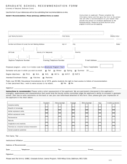

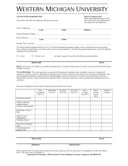


© Copyright 2025