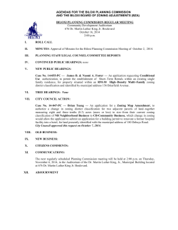
AGENDA 11/6/2014 ZLDR
AGENDA
ZLDR
AMENDMENTS
PUBLIC HEARING
11/6/2014
Post & Courier – Oct. 17, 2014
CHARLESTON COUNTY COUNCIL PUBLIC HEARING:
ZONING AND LAND DEVELOPMENT REGULATIONS ORDINANCE AMENDMENTS
Charleston County Council will hold a public hearing on the following proposed amendments to the Charleston
County Zoning and Land Development Regulations Ordinance at 6:30 p.m., Thursday, November 6, 2014 in
Council Chambers at the Lonnie Hamilton III, Public Services Building, 4045 Bridge View Drive, North
Charleston, South Carolina, 29405:
a) Article 5.5, MP-O, Mount Pleasant Overlay Zoning District: Clarify allowed and prohibited uses.
b) Article 5.6, FRC-O, Folly Road Corridor Overlay Zoning District: Amend the boundaries and clarify
uses in the South Village Area.
c) Table 6.1-1, Use Table, and Chapter 12, Definitions: Clarify towing and impound yard use
regulations and definitions.
Complete versions of proposed text amendments can be obtained on-line at the Charleston County Web Site
(www.charlestoncounty.org) or by contacting the Charleston County Planning Department at (843) 202-7200.
This Public Notice is in accordance with Section 6-29-760 of the Code of Laws of South Carolina.
Beverly T. Craven
Clerk of Council
PROPOSED TEXT AMENDMENTS TO THE CHARLESTON COUNTY
ZONING AND LAND DEVELOPMENT REGULATIONS ORDINANCE (ZLDR)
PUBLIC HEARING: NOVEMBER 6, 2014
Summary of Proposed Amendments:
Article 5.5, MP-O, Mount Pleasant Overlay Zoning District: Clarify allowed and prohibited uses.
The full text of the proposed amendment is attached.
Staff Recommendation:
Consideration of amendments to the ZLDR.
Planning Commission Recommendation: October 13, 2014
Approval (8 to 0)
Speakers: No citizens spoke during the meeting. The Town of Mount Pleasant sent a letter of support prior
to the Planning Commission meeting (attached in this packet).
Notifications:
The Planning Commission meeting was noticed in the Post & Courier and notifications were sent to more
than 300 people on the ZLDR/Comprehensive Plan Interested Parties’ List on September 26, 2014.
Public Hearing: November 6, 2014
Notifications:
The public hearing was noticed in the Post & Courier and notifications were sent to more than 300 people
on the ZLDR/Comprehensive Plan Interested Parties’ List on October 17, 2014.
Page 1 of 1
Legend: Proposed deletions shown in strikethrough text;
Proposed additions shown in bold, italic, red text
CHAPTER/ARTICLE/SECTION #: Article 5.5 MP-O Mount Pleasant Overlay District, Section
5.5.14, Uses
REASON FOR AMENDMENT:
Clarify and amend uses allowed in the Mont Pleasant Overlay District
DATE:
10/3/2014
______________________________________________________________________________________
PROPOSED AMENDMENTS:
§5.5.14
A.
B.
C.
D.
USES
The following principle uses shall be prohibited on parcels included in the
Mount Pleasant Overlay Zoning District:
1.
Auto Dealers, New and Used
2.
Vehicle Storage
3.
Boat/RV Storage Sexually Oriented Businesses
4.
Billboards
5.
Gun Shops and/or Indoor/Outdoor Shooting Ranges
6.
Liquor, Beer, or Wine Sales (as defined in this Ordinance)
The following use is uses are subject to the Special Exception procedures of
this Ordinance:
1.
Bar or Lounge
2.
Liquor, Beer, or Wine Sales (as defined in this Ordinance)
3.
Gun Shops and/or Indoor/Outdoor Shooting Ranges
4.
Boat/RV Storage
The following use is uses are allowed on any Industrial (I) zoned parcel
located west (inside) Interstate 526 if a Special Exception is granted by the
Board of Zoning Appeals. Otherwise, these uses shall be prohibited.
1.
Warehousing and Freight Movement
Warehousing, Distribution and Freight Forward Facilities
2.
Freight Container Storage Yards
3.
Fuel Storage Facility
4.
Stockpiling of Sand, Gravel or other Aggregate Materials
All uses other than Single Family Residential uses must complete the Site Plan
Review process as detailed in Article 3.7 of this Ordinance.
PROPOSED TEXT AMENDMENTS TO THE CHARLESTON COUNTY
ZONING AND LAND DEVELOPMENT REGULATIONS ORDINANCE (ZLDR)
PUBLIC HEARING: NOVEMBER 6, 2014
Summary of Proposed Amendments:
Article 5.6, FRC-O, Folly Road Corridor Overlay Zoning District: Amend the boundaries and clarify uses in
the South Village Area.
The full text of the proposed amendment is attached.
Staff Recommendation:
Consideration of amendments to the ZLDR.
Planning Commission Recommendation: October 13, 2014
Approval (8 to 0)
Speakers:
Two citizens spoke in support of these amendments. No speakers spoke in opposition.
Notifications:
The Planning Commission meeting was noticed in the Post & Courier, and notifications were sent to more
than 300 people on the ZLDR/Comprehensive Plan Interested Parties’ List on September 26, 2014.
Public Hearing: November 6, 2014
Notifications:
The public hearing was noticed in the Post & Courier, and notifications were sent to more than 300 people
on the ZLDR/Comprehensive Plan Interested Parties’ List on October 17, 2014.
Page 1 of 1
Legend: Proposed deletions shown in strikethrough text;
Proposed additions shown in bold, italic, red text
CHAPTER/ARTICLE/SECTION #: Article 5.6 FRC-O Folly Road Corridor Overlay District,
Sections 5.6.6 Development Standards And Requirements (All
Areas) and 5.6.9 South Village Area
REASON FOR AMENDMENT:
Clarify and amend uses allowed in Folly Road Corridor Overlay District
DATE:
10/3/2014
______________________________________________________________________________________
PROPOSED AMENDMENTS:
§5.6.6
DEVELOPMENT STANDARDS AND REQUIREMENTS (ALL AREAS)
The following development standards and requirements apply to all parcels within the Folly
Road Corridor Overlay Zoning District in addition to the requirements described below for each
of the five Areas. All non-single family detached development applications shall, at the time
application is made, provide proof that the following requirements will be met prior to the
issuance of any approvals or zoning permits:
G.
Noise
All Activity must comply with the Charleston County Livability Ordinance.
There shall be no pick-up or delivery of trash or merchandise scheduled
for businesses in these areas between the hours of 11:00 pm and 7:00
am. Any proposed outdoor use that provides live or amplified music
shall comply with the Special Exception provisions contained in this
Ordinance.
H.
Multiple Use Overlay Zoning District
Parcels that meet the criteria of Article 5.8, MU-O Multiple Use Overlay
Zoning District, may be developed in accordance with that Article.
-------------------------------------------------------------------------------------------------------------------------------
§5.6.9
SOUTH VILLAGE AREA
(City of Charleston, Town of James Island, and Charleston County)
The South Village area extends from Prescott Street to Rafael Lane South Grimball Rd /
Grimball Rd. Ext. as illustrated on the FRC-O map entitled “South Village Area.” Parcels in this
Area are within the jurisdiction of the Town of James Island and the City of Charleston, with a
few parcels in and unincorporated Charleston County. This Area currently consists of mixed
medium to high intensity commercial development, such as shopping centers big box stores and
consumer services, along the west side of Folly Road and primarily small scale office and
residential uses along the east side of Folly Road. This Area is intended for development similar
to the North Village Area with less intense commercial development than the Commercial Core
Area and a mix of medium to high intensity uses along the west side of Folly Road and lower
intensity development on the east side of Folly Road. Future development in this Area is to be a
mix of commercial and residential uses with increased right-of-way buffers along the west side
of Folly Road and increased land use buffers on both sides of Folly Road when commercial
development occurs adjacent to single family detached residential uses. The following
regulations apply in addition to the requirements of Section 5.6.6 of this Article to
unincorporated parcels along Folly Road as indicated on the map titled “South Village Area”:
Legend: Proposed deletions shown in strikethrough text;
Proposed additions shown in bold, italic, red text
A.
Permitted uses
Permitted uses shall include those uses allowed in the zoning district(s) that
corresponds with the “R”, “OR”, “CN,” and “CC” future land use designation as
shown on the overlay zoning district map and as described in Table 6.1.1, Use
Table. Civic and institutional uses as described in Table 6.1.1 shall be permitted
for properties shown in the Civic/Institutional future land use designation.
B.
Prohibited uses
Auto Dealers (New and Used) Billboards, Indoor/Outdoor Shooting Ranges,
Liquor, Hotels or Motels (greater than ten rooms) and Tattoo parlors shall be
prohibited in this Area.
C.
Uses Requiring Special Exception
Vehicle Storage, Boat/RV Storage, Bar or Lounge, Consumer Vehicle Repair,
Fast Food Restaurant, Gasoline Service Stations (with or without convenience
stores), Indoor Recreation and Entertainment, Consumer Vehicle Repair uses
shall require Special Exception approval in compliance with the procedures
contained in this Ordinance.
D.
Buffers
1. A minimum 15-foot vegetated right-of-way buffer shall be required along the
east side of Folly Road and a minimum 35-foot vegetated right-of-way
buffer shall be required along the west side of Folly Road;
2. A minimum 20-foot vegetated rear buffer shall be required adjacent to
residential uses; and
3. Fencing may be required to screen adjacent or surrounding residential
uses. When a minimum 6-foot high opaque fence or wall is utilized, the
Planning Director may reduce the land use buffer by up to one-half (1/2) its
required depth when deemed appropriate; however, no required vegetated
buffer shall be less than 10 feet in depth.
COKE R AV
MINOTT ST
Folly Road Corridor
Overlay Zoning District
HA
RB
O
UE A
D
AV E N
O
O
TW
S
E
W
RD
South Village
Area
BA
LL
RI
M
G
RD
X
RD E
B AL L
GRIM
RD
OD
KW
O
LA
R
City of Folly Beach
Marsh
LE E W AR
Water
D AV
Water Features
RD
SC HO O
NE R R D
LYN NE AV
DR
RD
R
MA T
A
L
S
RT ON
FO R IS
R
DR
GA
ON
LI
A
TT
BA
T
HA Z
Z
AR
N
NE
S
UR
TR
D
SB
R
TE
RN
S
D
L
FO
LY
RD
DR
EE
NK
T
YA
PS
RIM
SH
L
SO
RE
GA
LE
RD
E
0.7
1.05
T
1.4
Miles
RS
0.175 0.35
E
NT
CE
Draft: Sept 22, 2014
0
TAB BY DR
LIT
TL E
/
DR
OA
KD
R
OA K IS LA ND
Conservation Area
D
DR
LE
S
ST
I
Town of James Island
RD
N
A RD
L
US
LN
T
LO
Neighborhood
Preservation Area
EB
ITAR Y
OLD MIL
LN
LL R D
SA LL IE ST
RD
City of Charleston
RA INB
BU R C OW R D
L A RE
RA FE
DR
AL L N
SC OTT HILL
S
EL IA
S GR IMBA
N
SO
HN
JO
ER
County of Charleston (outside OD area)
OUS E
MA R IN B LV D
ER D R
IR
DC
HE
L
AV
U
AV E N
AV
SE
AS
GR ID E
EE L N
NH
IL L
I
AP
TR
Munic ipal B oundaries
R LN
PA ULINE
R
DR
HE R
M
RT
FO
IR
AC
UB
AR
VA
LE
R
SE A
TD
UR D
TH AIL
AR QU
RE
WAY FA
KC
RE
S
Community Commercial
FRED ST
BR UC E
ST
Water-Dependent
Commercial
R
EAGLEW OOD TR
DR
LN
AP E X
OA
Neighborhood Commercial
RD
IE W
A NV
OCE
RD
BE N L RD
IL
EY H
RD
ST
HON
O
P
NE
ST O
L AV
R
TE A
ED
A IR
WN
LN
M
ID
General Office
D
MIKE LL DR
LN
BL A ZE
Office Residential
R
ST
K
DE E
TO
RK
YO
DE V ON
S AV
LYN TON AV
EW
D
SA
V
ITA
GE
AV
CA M
PR
D
VI
R
T
ES
ND DR
L
HA
Commercial
Area
Residential
R
EI
W
DR
T
WI
CK
Overlay District Boundary WA MPL ER DR
DR
Future Land U se
N
DO
ST
NS
DA
MU
D
BRA NTLEY DR
N
CO
R
BE
DA
JOR
YR
A
RIV E RL
BRADH AM RD
Overlay District Areas (revised)
EL
SW ANSON AV
RD
E
RIL
LUCK Y RD
CA R
M
LIGH TH
RK
Legend
RD
PA
Y
DIL
LS
BL U
FF
L
RA
NT
E
C
PW
WOOD
S IDE D
R
G
IN
I
EX
JUL IA
ST
DIL L A
V
KELL PL
LL
RD
S
ME
JA
SL
D
AN
W
RV IE
CL E A
HO
S
DR AV
N
TON
GH CA RL I
DR
CA N
U
HO
E
YA L
North Village
Area
ST
AL
R
ES D
R
OD
FL EMIN G RD
Y
STE FAN DR
HOWL E AV
HW
V
CH E
K
E LL
AN
YB
MA ST
Y
XC
MA
RT
MA
ED IS TO AV
CA RO L ST
WOODLAND SHOR ES RD
WA PP OO DR
AV E AV A
ON E R I
E
E
UR
H
AV
E
C
I
T
RC
EA
LE
SH
V
YA
O
CO
PE
V
RA
R
Folly Road Corridor
Overlay Zoning District D
R
N
Neighborhood Preservtion
DE
GR
IM
BA
LL
RA IN B
O
AD
GL
OT
SC
Future Land U se
IL L
TH
RD
South Village
Area
COMMUNTY COMMERCIAL
NEIGHBORHOOD COMMERCIAL
Munic ipal B oundaries
County of Charleston (outside OD area)
Town of James Island
Water Features
S
TU
LO
MAR Y ROPER LN
D
AU R
Neighborhood
Preservation Area
HA Z
Z
I
PR
RS
EA
CL
AR D
LN
LN
LN
ILY
IOL E
S PR
YL
DA
JA ME
AR Y RD
OL D MIL IT
T
SA LL IE S
T
D EX
RD
AL L RD
S GR IMB
R
BA LL
GRIM
CE
BRY
NATHANIEL DR
LN
Marsh
IS MA EL RD
Water
NIE
DON
City of Charleston
FO L
LY
RD
Overlay District Areas (revised)
Ov erlay District Areas
W RD
BU R C
L A RE
DR
ROS E
PAR K
D
RA FE
R
AL L N
Legend
NG
DR
RY
TE
T
BA
Draft: Sept. 22, 2014
0.0325 0.065
0.13
0.195
0.26
Miles
RD
R
DE
UD
CT
N
SC
AI
TW
OLD FO LLY RD
RD
0
N
UR
SB
AR
/
D
AN
L
S
I
ND AV
SECESSION VILLE RD
RD
WES T
M OR
EL A
DR
Conservation Area
Commercial Area
City of Charleston
Town of James Island
Water
Marsh
N ST
FO LLY
Water Features
WILT
O
AR U
B
County of Charleston (outside OD area)
N
SO
HN
O
J
RT
FO
RD
BA RB
AD OS
WAY
Munic ipal B oundaries
D
FIT H BLV
AC
IR
G RIF
GE ORG E
NEIGHBORHOOD COMMERCIAL
DR
X LN
AP E
COMMUNTY COMMERCIAL
B
BR
ST
DR
S ON
SA M
G
RI
M
BA
LL
RD
OO
T
W
F
T
RO
ES
C
A
W
SE
ST
D
EE
ES
D
RD
UE
AVE N
ST
ST
R
R
FR EE
R
WITT E
R DS
JE FF O
South Village
Area
R
DO
WN
ER
PINNACLE LN
Ov erlay District Boundary
OA
KC
RE
ST
D
PAU LIN E
AV
AV
FO RD
BR AD
Overlay District Areas (revised)
Future Land U se
RE
NW
OO
DD
WO
R
OD
S ID
ED
R
NEWBURY ST
N DR
RIVERLAND DR
LYNTO N AV
W
YO RK TO
LN
EN RD
BL AZ E
DE XT ER LN
ST
Legend
P
TU RK EY
Y
NN
DA
Folly Road Corridor
Overlay Zoning District
T
O VE S
South
ONE L Village Area
WOODVIEW LN
RD
E
UN
RT
ON
ST
LE
DE
FO
R
Draft: Sept. 22, 2014
0.19
0.285
0.38
Miles
T
SA LL IE S
D
B AL L R
S GR IM
RD
BA LL
M
I
R
G
E XT
Neighborhood
Preservation Area
AR Y RD
OL D MIL IT
NATHANIEL DR
D
E LN
ER
AT
W
NI
DON
LN
0.0475 0.095
HIL
IS MA EL RD
S
EL IA
0
T
OT
SC
CU FF Y
LN
A
SE
/
ST
LN
RD
EL
MU
SA
PAUL CHAVIS LN
DR
AY
W
ST
WE
D
R
T
WES T
L P OIN
M OR
SIGN A
EL A N
D AV
RA IN B
OW R
D
BU R C
L A RE
DR
RA FE
A
L LN
D
LR
PROPOSED TEXT AMENDMENTS TO THE CHARLESTON COUNTY
ZONING AND LAND DEVELOPMENT REGULATIONS ORDINANCE (ZLDR)
PUBLIC HEARING: NOVEMBER 6, 2014
Summary of Proposed Amendments:
Table 6.1-1, Use Table, and Chapter 12, Definitions: Clarify towing and impound yard use regulations and
definitions.
The full text of the proposed amendment is attached.
Staff Recommendation:
Consideration of amendments to the ZLDR.
Planning Commission Recommendation: October 13, 2014
Approval (8 to 0)
Speakers:
Four citizens spoke in support of these amendments. No one spoke in opposition.
Notifications:
The Planning Commission meeting was noticed in the Post & Courier, and notifications were sent to more
than 300 people on the ZLDR/Comprehensive Plan Interested Parties’ List on September 26, 2014.
Public Hearing: November 6, 2014
Notifications:
The public hearing was noticed in the Post & Courier, and notifications were sent to more than 300 people
on the ZLDR/Comprehensive Plan Interested Parties’ List on October 17, 2014.
Page 1 of 1
Legend: Proposed deletions shown in strikethrough text;
Proposed additions shown in bold, italic, red text
CHAPTER/ARTICLE/SECTION #: Table 6.1-1, Use Table, and Chapter 12, Definitions
REASON FOR AMENDMENT:
Clarify towing and impound yard use regulations and definitions
DATE:
10/3/2014
______________________________________________________________________________________
PROPOSED AMENDMENTS:
Table 6.1.1, USE TABLE
ZONING DISTRICTS
TABLE
6.1-1
RM
AG
15
AG
10
AG
8
AGR
RR3
S3
R4
M8
M
12
MHS
MHP
OR
OG
CN
CR
CT
CC
I
A
A
COMMERCIAL
VEHICLE AND WATERCRAFT STORAGE
Vehicle
Storage,
including
Bus
Barns,
Boat or
RV
Storage,
or
Impound
Yards
Towing
Facility
Impound
Yard
A
A
§12.1, TERMS AND USES DEFINED
Scrap and
An establishment primarily engaged in the storage, retail or wholesale sale,
Salvage Service
assembling, dismantling, sorting, distributing, or other processing of scrap, used
(or Junk Yard)
equipment, mechanical components, or waste materials. This terms excludes
impound yards and towing facilities.
Vehicle Storage
An establishment offering long or short term storage of operating vehicles or
vehicles contracted for repair. This term excludes impound yards, towing
facilities, and any dismantling, scrap and salvage service, or junked vehicle yards.
Towing Facility
An establishment that provides vehicle towing services and accessory temporary
outdoor storage for the vehicles it tows, which shall only include: (1)
mechanically operable/driveable, licensed vehicles that are to be claimed by
titleholders or their agents; and/or (2) wrecked motor vehicles awaiting insurance
adjustments and transport to repair shops. This term excludes: automotive
services that have a tow truck on-site; scrap and salvage yards/services; junk
yards; impound yards; vehicle storage; and accessory storage of inoperable
vehicles.
Impound Yard
A facility that provides temporary outdoor storage for: (1) mechanically
operable/driveable, licensed vehicles that are to be claimed by titleholders or their
agents; and/or (2) wrecked motor vehicles awaiting insurance adjustments and
transport to repair shops. This term excludes: scrap and salvage yards/services;
junk yard; towing facilities; vehicle storage; and accessory storage of inoperable
vehicles.
Draft – October 3, 2014
Page 1 of 1
Condition
© Copyright 2025
